Grenant-lès-Sombernon | |
|---|---|
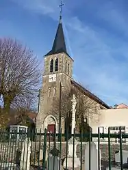 The church in Grenant-lès-Sombernon | |
.svg.png.webp) Coat of arms | |
Location of Grenant-lès-Sombernon | |
 Grenant-lès-Sombernon 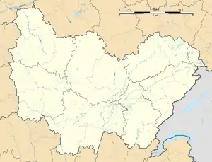 Grenant-lès-Sombernon | |
| Coordinates: 47°16′20″N 4°42′44″E / 47.2722°N 4.7122°E | |
| Country | France |
| Region | Bourgogne-Franche-Comté |
| Department | Côte-d'Or |
| Arrondissement | Dijon |
| Canton | Talant |
| Government | |
| • Mayor (2020–2026) | Jean-Luc Lecour[1] |
| Area 1 | 7.19 km2 (2.78 sq mi) |
| Population | 212 |
| • Density | 29/km2 (76/sq mi) |
| Time zone | UTC+01:00 (CET) |
| • Summer (DST) | UTC+02:00 (CEST) |
| INSEE/Postal code | 21306 /21540 |
| Elevation | 370–580 m (1,210–1,900 ft) (avg. 570 m or 1,870 ft) |
| 1 French Land Register data, which excludes lakes, ponds, glaciers > 1 km2 (0.386 sq mi or 247 acres) and river estuaries. | |
Grenant-lès-Sombernon (French pronunciation: [ɡʁənɑ̃ lɛ sɔ̃bɛʁnɔ̃], literally Grenant near Sombernon) is a commune in the Côte-d'Or department in eastern France.
Prior to September 16, 2005, it was known as Grenand-lès-Sombernon.[3]
Population
| Year | Pop. | ±% |
|---|---|---|
| 1962 | 98 | — |
| 1968 | 110 | +12.2% |
| 1975 | 87 | −20.9% |
| 1982 | 109 | +25.3% |
| 1990 | 121 | +11.0% |
| 1999 | 138 | +14.0% |
| 2008 | 194 | +40.6% |
See also
References
- ↑ "Répertoire national des élus: les maires". data.gouv.fr, Plateforme ouverte des données publiques françaises (in French). 2 December 2020.
- ↑ "Populations légales 2020". The National Institute of Statistics and Economic Studies. 29 December 2022.
- ↑ "Décret n° 2005-1155 du 12 septembre 2005 portant changement de nom de communes". Légifrance (in French).
Wikimedia Commons has media related to Grenant-lès-Sombernon.
This article is issued from Wikipedia. The text is licensed under Creative Commons - Attribution - Sharealike. Additional terms may apply for the media files.