Grangues | |
|---|---|
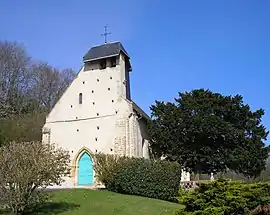 The church in Grangues | |
Location of Grangues | |
 Grangues  Grangues | |
| Coordinates: 49°16′02″N 0°03′14″W / 49.2672°N 0.0539°W | |
| Country | France |
| Region | Normandy |
| Department | Calvados |
| Arrondissement | Lisieux |
| Canton | Cabourg |
| Government | |
| • Mayor (2020–2026) | Denis Moisson[1] |
| Area 1 | 6.61 km2 (2.55 sq mi) |
| Population | 276 |
| • Density | 42/km2 (110/sq mi) |
| Time zone | UTC+01:00 (CET) |
| • Summer (DST) | UTC+02:00 (CEST) |
| INSEE/Postal code | 14316 /14160 |
| Elevation | 16–141 m (52–463 ft) (avg. 130 m or 430 ft) |
| 1 French Land Register data, which excludes lakes, ponds, glaciers > 1 km2 (0.386 sq mi or 247 acres) and river estuaries. | |
Grangues (French pronunciation: [ɡʁɑ̃ɡ] ⓘ) is a commune in the Calvados department and Normandy region of north-western France.
Population
| Year | Pop. | ±% |
|---|---|---|
| 1946 | 214 | — |
| 1954 | 200 | −6.5% |
| 1962 | 215 | +7.5% |
| 1968 | 161 | −25.1% |
| 1975 | 143 | −11.2% |
| 1982 | 180 | +25.9% |
| 1990 | 184 | +2.2% |
| 1999 | 241 | +31.0% |
| 2008 | 236 | −2.1% |
| 2014 | 244 | +3.4% |
Name
The attested forms are de Girangis, without date (cartulary of Préaux) ;[3] Granchae in 1198 (magni rotuli scacc. p. 58, 2) ;[4] [Johannes de] Guerengues in 1216 (AC, H 321); [Apud] Grengueis in 1220 ; Grengues in 1282 (AN, J 220,2) ;[5][3] Greyngues in 1282 (cart. norm. n° 996, p. 256) ; Granges Generenciæ in the 13th century (cart. of Préaux) ; Grenguez 14th century ; Grenchiæ 16th century (Lisieux, p. 52).[4]
This is a medieval toponymic formation, probably old since it is not preceded by the definite article. François de Beaurepaire brings Grangues closer to Goring (Oxford, Garinges 10th century); Goring (Sussex, Garinges 10th century) and Gerringe (Denmark, Gaeringhe 1470), without specifying the etymology.[3] The two British Gorings admit as etymology, either "property of the family or relatives of a man called *Gāra, an unattested Old English personal name, followed by the Germanic suffix -ingas, [6][7] or “the people at the end, from the corner of the piece of land”, on Old English gāra 'piece of land' + suffix -ingas.[6] The Old Norse word geiri influenced by the Old English gāra 'piece of land, probably triangular' > gaire, is well attested in Norman toponymy, generally it gave the microtoponyms La Gare or La Guerre.[8][9]
See also
References
- ↑ "Répertoire national des élus: les maires" (in French). data.gouv.fr, Plateforme ouverte des données publiques françaises. 13 September 2022.
- ↑ "Populations légales 2020". The National Institute of Statistics and Economic Studies. 29 December 2022.
- 1 2 3 François |name1=de Beaurepaire, The Place Names of Calvados (annotated by Dominique Fournier), Paris, L'Harmattan, 2022, p. 201-202, ISBN 978-2-14-028854-8
- 1 2 Célestin Hippeau, Topographical Dictionary of Calvados, Paris, 1883, p. 133.
- ↑ Arcisse de Caumont, Monumental Statistics of Calvados, Hardel, Caen, 1862, volume 4 in Arrondissement de Pont-l'Évêque, p. 90
- 1 2 Glover, Judith, Sussex Place-Names: Their Origins and Meanings, Countryside Books, 1997 ISBN 978-1-85306-484-5
- ↑ A. D. Mills, A Dictionary of British Place Names, Oxford University Press, Print Publication: 2011, Print ISBN 9780199609086, Published online: 2011, Current Online Version: 2011, ISBN 9780191739446, p. 308 (read online)
- ↑ Élisabeth Ridel, the Vikings and the words: The contribution of ancient Scandinavian to the French language, éditions errance, Paris, 2009, p. 215.
- ↑ Guy Chartier, “Of some Norman toponyms” in Nouvelle revue d'onomastique, 2000, n° 35-36, p. 280 - 281