Grandfontaine-sur-Creuse | |
|---|---|
 The chapel in Grandfontaine-sur-Creuse | |
Location of Grandfontaine-sur-Creuse | |
 Grandfontaine-sur-Creuse 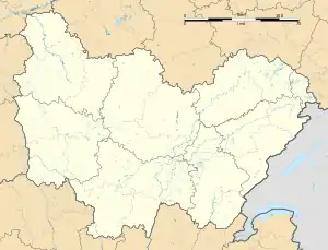 Grandfontaine-sur-Creuse | |
| Coordinates: 47°11′37″N 6°27′18″E / 47.1936°N 6.455°E | |
| Country | France |
| Region | Bourgogne-Franche-Comté |
| Department | Doubs |
| Arrondissement | Pontarlier |
| Canton | Valdahon |
| Intercommunality | Portes du Haut-Doubs |
| Government | |
| • Mayor (2020–2026) | Pascal Locatelli[1] |
| Area 1 | 5.9 km2 (2.3 sq mi) |
| Population | 74 |
| • Density | 13/km2 (32/sq mi) |
| Time zone | UTC+01:00 (CET) |
| • Summer (DST) | UTC+02:00 (CEST) |
| INSEE/Postal code | 25289 /25510 |
| Elevation | 684–744 m (2,244–2,441 ft) |
| 1 French Land Register data, which excludes lakes, ponds, glaciers > 1 km2 (0.386 sq mi or 247 acres) and river estuaries. | |
Grandfontaine-sur-Creuse (French pronunciation: [ɡʁɑ̃fɔ̃tɛn syʁ kʁøz]) is a commune in the Doubs department in the Bourgogne-Franche-Comté region in eastern France.
Population
| Year | Pop. | ±% |
|---|---|---|
| 1962 | 99 | — |
| 1968 | 112 | +13.1% |
| 1975 | 101 | −9.8% |
| 1982 | 84 | −16.8% |
| 1990 | 70 | −16.7% |
| 1999 | 74 | +5.7% |
| 2008 | 88 | +18.9% |
| 2012 | 77 | −12.5% |
See also
References
- ↑ "Répertoire national des élus: les maires" (in French). data.gouv.fr, Plateforme ouverte des données publiques françaises. 13 September 2022.
- ↑ "Populations légales 2020". The National Institute of Statistics and Economic Studies. 29 December 2022.
Wikimedia Commons has media related to Grandfontaine-sur-Creuse.
This article is issued from Wikipedia. The text is licensed under Creative Commons - Attribution - Sharealike. Additional terms may apply for the media files.