Gerersdorf-Sulz | |
|---|---|
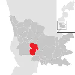 Location within Güssing district | |
 Gerersdorf-Sulz Location within Austria | |
| Coordinates: 47°4′N 16°15′E / 47.067°N 16.250°E | |
| Country | Austria |
| State | Burgenland |
| District | Güssing |
| Government | |
| • Mayor | Roman Jandrisevits (SPÖ) |
| Area | |
| • Total | 21.63 km2 (8.35 sq mi) |
| Elevation | 226 m (741 ft) |
| Population (2018-01-01)[2] | |
| • Total | 1,014 |
| • Density | 47/km2 (120/sq mi) |
| Time zone | UTC+1 (CET) |
| • Summer (DST) | UTC+2 (CEST) |
| Postal code | 7541 |
| Website | www.gerersdorf-sulz.at |
Gerersdorf-Sulz ((Hungarian: Németszentgrót-Sóskútfalu) is a municipality in the district of Güssing in the Austrian state of Burgenland.
Population
| Year | Pop. | ±% |
|---|---|---|
| 1869 | 1,833 | — |
| 1880 | 1,849 | +0.9% |
| 1890 | 2,078 | +12.4% |
| 1900 | 1,964 | −5.5% |
| 1910 | 1,823 | −7.2% |
| 1923 | 1,698 | −6.9% |
| 1934 | 1,604 | −5.5% |
| 1939 | 1,411 | −12.0% |
| 1951 | 1,459 | +3.4% |
| 1961 | 1,215 | −16.7% |
| 1971 | 1,177 | −3.1% |
| 1981 | 1,148 | −2.5% |
| 1991 | 1,093 | −4.8% |
| 2001 | 1,057 | −3.3% |
| 2011 | 1,050 | −0.7% |
| 2021 | 1,003 | −4.5% |
References
- ↑ "Dauersiedlungsraum der Gemeinden Politischen Bezirke und Bundesländer - Gebietsstand 1.1.2018". Statistics Austria. Retrieved 10 March 2019.
- ↑ "Einwohnerzahl 1.1.2018 nach Gemeinden mit Status, Gebietsstand 1.1.2018". Statistics Austria. Retrieved 9 March 2019.
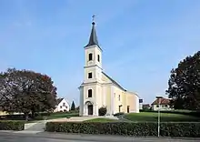
Parish church at Gerersdorf
This article is issued from Wikipedia. The text is licensed under Creative Commons - Attribution - Sharealike. Additional terms may apply for the media files.