Francières | |
|---|---|
.JPG.webp) The town hall and school in Francières | |
 Coat of arms | |
Location of Francières | |
 Francières 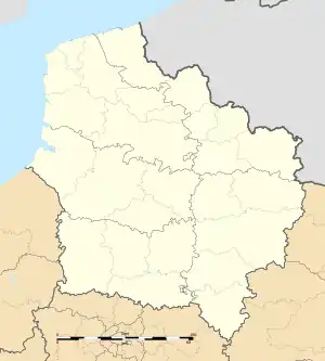 Francières | |
| Coordinates: 50°04′23″N 1°56′33″E / 50.0731°N 1.9425°E | |
| Country | France |
| Region | Hauts-de-France |
| Department | Somme |
| Arrondissement | Abbeville |
| Canton | Rue |
| Intercommunality | CC Ponthieu-Marquenterre |
| Government | |
| • Mayor (2020–2026) | Jean-Claude Dulys[1] |
| Area 1 | 5.81 km2 (2.24 sq mi) |
| Population | 178 |
| • Density | 31/km2 (79/sq mi) |
| Time zone | UTC+01:00 (CET) |
| • Summer (DST) | UTC+02:00 (CEST) |
| INSEE/Postal code | 80344 /80690 |
| Elevation | 33–110 m (108–361 ft) (avg. 70 m or 230 ft) |
| 1 French Land Register data, which excludes lakes, ponds, glaciers > 1 km2 (0.386 sq mi or 247 acres) and river estuaries. | |
Francières (French pronunciation: [fʁɑ̃sjɛʁ]) is a commune in the Somme department in Hauts-de-France in northern France.
Geography
The commune is situated on the D183e road, some 7 miles (11 km) southeast of Abbeville.
Population
| Year | Pop. | ±% p.a. |
|---|---|---|
| 1968 | 129 | — |
| 1975 | 140 | +1.18% |
| 1982 | 142 | +0.20% |
| 1990 | 129 | −1.19% |
| 1999 | 127 | −0.17% |
| 2007 | 177 | +4.24% |
| 2012 | 200 | +2.47% |
| 2017 | 194 | −0.61% |
| Source: INSEE[3] | ||
See also
References
- ↑ "Répertoire national des élus: les maires". data.gouv.fr, Plateforme ouverte des données publiques françaises (in French). 2 December 2020.
- ↑ "Populations légales 2020". The National Institute of Statistics and Economic Studies. 29 December 2022.
- ↑ Population en historique depuis 1968, INSEE
Wikimedia Commons has media related to Francières (Somme).
This article is issued from Wikipedia. The text is licensed under Creative Commons - Attribution - Sharealike. Additional terms may apply for the media files.