Chiping
茌平区 Chihping | |
|---|---|
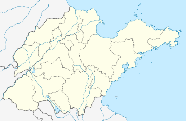 Chiping Location of the seat in Shandong | |
| Coordinates: 36°34′52″N 116°15′18″E / 36.581°N 116.255°E | |
| Country | People's Republic of China |
| Province | Shandong |
| Prefecture-level city | Liaocheng |
| Area | |
| • Total | 1,003 km2 (387 sq mi) |
| Population (2019)[2] | |
| • Total | 545,500 |
| • Density | 540/km2 (1,400/sq mi) |
| Time zone | UTC+8 (China Standard) |
| Postal code | 252100 |
Chiping District (Chinese: 茌平区; pinyin: Chípíng Qū) is a district of northwestern Shandong province, People's Republic of China. It is administered by Liaocheng, and is 120 kilometres (75 mi) west of Jinan, the provincial capital.
The population was 565,756 in 1999.[3]
Administrative divisions
As 2012, this District is divided to 2 subdistricts, 6 towns and 8 townships.[4]
- Subdistricts
- Zhenxing Subdistrict (振兴街道)
- Xinfa Subdistrict (信发街道)
- Towns
|
- Townships
|
|
Climate
| Climate data for Chiping (1991–2020 normals, extremes 1981–2010) | |||||||||||||
|---|---|---|---|---|---|---|---|---|---|---|---|---|---|
| Month | Jan | Feb | Mar | Apr | May | Jun | Jul | Aug | Sep | Oct | Nov | Dec | Year |
| Record high °C (°F) | 18.0 (64.4) |
21.7 (71.1) |
28.1 (82.6) |
32.0 (89.6) |
38.6 (101.5) |
41.8 (107.2) |
41.8 (107.2) |
36.3 (97.3) |
36.1 (97.0) |
33.2 (91.8) |
26.3 (79.3) |
17.8 (64.0) |
41.8 (107.2) |
| Average high °C (°F) | 4.1 (39.4) |
8.1 (46.6) |
14.4 (57.9) |
20.9 (69.6) |
26.4 (79.5) |
31.7 (89.1) |
32.0 (89.6) |
30.4 (86.7) |
27.1 (80.8) |
21.2 (70.2) |
12.6 (54.7) |
5.7 (42.3) |
19.6 (67.2) |
| Daily mean °C (°F) | −1.5 (29.3) |
2.1 (35.8) |
8.2 (46.8) |
14.7 (58.5) |
20.4 (68.7) |
25.6 (78.1) |
27.1 (80.8) |
25.6 (78.1) |
20.9 (69.6) |
14.8 (58.6) |
6.9 (44.4) |
0.4 (32.7) |
13.8 (56.8) |
| Average low °C (°F) | −5.8 (21.6) |
−2.7 (27.1) |
2.7 (36.9) |
8.9 (48.0) |
14.5 (58.1) |
19.9 (67.8) |
23.0 (73.4) |
21.7 (71.1) |
16.0 (60.8) |
9.6 (49.3) |
2.3 (36.1) |
−3.8 (25.2) |
8.9 (48.0) |
| Record low °C (°F) | −22.3 (−8.1) |
−18.0 (−0.4) |
−10.3 (13.5) |
−2.2 (28.0) |
4.1 (39.4) |
9.6 (49.3) |
15.9 (60.6) |
13.0 (55.4) |
4.1 (39.4) |
−3.6 (25.5) |
−17.1 (1.2) |
−18.9 (−2.0) |
−22.3 (−8.1) |
| Average precipitation mm (inches) | 3.8 (0.15) |
8.6 (0.34) |
11.0 (0.43) |
33.5 (1.32) |
55.6 (2.19) |
72.7 (2.86) |
152.5 (6.00) |
149.3 (5.88) |
51.9 (2.04) |
30.9 (1.22) |
19.4 (0.76) |
5.2 (0.20) |
594.4 (23.39) |
| Average precipitation days (≥ 0.1 mm) | 1.8 | 3.2 | 3.0 | 5.2 | 6.5 | 7.4 | 11.2 | 9.7 | 6.4 | 5.4 | 4.2 | 2.6 | 66.6 |
| Average snowy days | 2.7 | 2.8 | 0.7 | 0.1 | 0 | 0 | 0 | 0 | 0 | 0 | 0.9 | 2.0 | 9.2 |
| Average relative humidity (%) | 62 | 59 | 56 | 61 | 66 | 63 | 78 | 83 | 77 | 68 | 67 | 65 | 67 |
| Mean monthly sunshine hours | 146.1 | 149.6 | 205.2 | 226.7 | 249.3 | 223.5 | 184.5 | 182.5 | 187.1 | 181.7 | 149.5 | 143.9 | 2,229.6 |
| Percent possible sunshine | 47 | 48 | 55 | 57 | 57 | 51 | 42 | 44 | 51 | 53 | 49 | 48 | 50 |
| Source: China Meteorological Administration[5][6] | |||||||||||||
References
- ↑ 最新人口信息 www.hongheiku.com (in Chinese). hongheiku. Retrieved 2021-01-12.
- ↑ 最新人口信息 www.hongheiku.com (in Chinese). hongheiku. Retrieved 2021-01-12.
- ↑ National Population Statistics Materials by County and City - 1999 Period, in China County & City Population 1999, Harvard China Historical GIS
- ↑ 聊城市-行政区划网 www.xzqh.org (in Chinese). XZQH. Retrieved 2012-05-24.
- ↑ 中国气象数据网 – WeatherBk Data (in Simplified Chinese). China Meteorological Administration. Retrieved 12 August 2023.
- ↑ 中国气象数据网 (in Simplified Chinese). China Meteorological Administration. Retrieved 12 August 2023.
This article is issued from Wikipedia. The text is licensed under Creative Commons - Attribution - Sharealike. Additional terms may apply for the media files.