Châtillon-sur-Indre | |
|---|---|
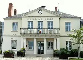 Town hall | |
.svg.png.webp) Coat of arms | |
Location of Châtillon-sur-Indre | |
 Châtillon-sur-Indre  Châtillon-sur-Indre | |
| Coordinates: 46°59′19″N 1°10′28″E / 46.9886°N 1.1744°E | |
| Country | France |
| Region | Centre-Val de Loire |
| Department | Indre |
| Arrondissement | Châteauroux |
| Canton | Buzançais |
| Government | |
| • Mayor (2020–2026) | Gérard Nicaud[1] |
| Area 1 | 45.3 km2 (17.5 sq mi) |
| Population | 2,326 |
| • Density | 51/km2 (130/sq mi) |
| Time zone | UTC+01:00 (CET) |
| • Summer (DST) | UTC+02:00 (CEST) |
| INSEE/Postal code | 36045 /36700 |
| Elevation | 82–148 m (269–486 ft) (avg. 88 m or 289 ft) |
| 1 French Land Register data, which excludes lakes, ponds, glaciers > 1 km2 (0.386 sq mi or 247 acres) and river estuaries. | |
Châtillon-sur-Indre (French pronunciation: [ʃatijɔ̃ syʁ‿ɛ̃dʁ] ⓘ, literally Châtillon on Indre) is a commune in the Indre department, central France.
Population
|
| ||||||||||||||||||||||||||||||||||||||||||||||||||||||||||||||||||||||||||||||||||||||||||||||||||||||||||||||||||
| Source: EHESS[3] and INSEE (1968-2017)[4] | |||||||||||||||||||||||||||||||||||||||||||||||||||||||||||||||||||||||||||||||||||||||||||||||||||||||||||||||||||
See also
References
- ↑ "Répertoire national des élus: les maires" (in French). data.gouv.fr, Plateforme ouverte des données publiques françaises. 13 September 2022.
- ↑ "Populations légales 2020". The National Institute of Statistics and Economic Studies. 29 December 2022.
- ↑ Des villages de Cassini aux communes d'aujourd'hui: Commune data sheet Châtillon-sur-Indre, EHESS (in French).
- ↑ Population en historique depuis 1968, INSEE
Wikimedia Commons has media related to Châtillon-sur-Indre.
This article is issued from Wikipedia. The text is licensed under Creative Commons - Attribution - Sharealike. Additional terms may apply for the media files.