Bagneux | |
|---|---|
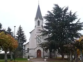 The church in Bagneux | |
Location of Bagneux | |
 Bagneux  Bagneux | |
| Coordinates: 47°11′02″N 1°45′14″E / 47.1839°N 1.7539°E | |
| Country | France |
| Region | Centre-Val de Loire |
| Department | Indre |
| Arrondissement | Issoudun |
| Canton | Valençay |
| Government | |
| • Mayor (2020–2026) | Michel Petit[1] |
| Area 1 | 25.3 km2 (9.8 sq mi) |
| Population | 174 |
| • Density | 6.9/km2 (18/sq mi) |
| Time zone | UTC+01:00 (CET) |
| • Summer (DST) | UTC+02:00 (CEST) |
| INSEE/Postal code | 36011 /36210 |
| Elevation | 92–146 m (302–479 ft) (avg. 143 m or 469 ft) |
| 1 French Land Register data, which excludes lakes, ponds, glaciers > 1 km2 (0.386 sq mi or 247 acres) and river estuaries. | |
Bagneux (French pronunciation: [baɲø] ⓘ) is a commune in the Indre département in central France.
Population
| Year | Pop. | ±% p.a. |
|---|---|---|
| 1968 | 287 | — |
| 1975 | 242 | −2.41% |
| 1982 | 193 | −3.18% |
| 1990 | 169 | −1.65% |
| 1999 | 174 | +0.32% |
| 2009 | 192 | +0.99% |
| 2014 | 174 | −1.95% |
| 2020 | 174 | +0.00% |
| Source: INSEE[3] | ||
See also
References
- ↑ "Répertoire national des élus: les maires". data.gouv.fr, Plateforme ouverte des données publiques françaises (in French). 2 December 2020.
- ↑ "Populations légales 2020". The National Institute of Statistics and Economic Studies. 29 December 2022.
- ↑ Population en historique depuis 1968, INSEE
Wikimedia Commons has media related to Bagneux (Indre).
This article is issued from Wikipedia. The text is licensed under Creative Commons - Attribution - Sharealike. Additional terms may apply for the media files.