Bouy | |
|---|---|
 The town hall in Bouy | |
 Coat of arms | |
Location of Bouy | |
 Bouy  Bouy | |
| Coordinates: 49°05′14″N 4°21′01″E / 49.0872°N 4.3503°E | |
| Country | France |
| Region | Grand Est |
| Department | Marne |
| Arrondissement | Châlons-en-Champagne |
| Canton | Mourmelon-Vesle et Monts de Champagne |
| Intercommunality | CA Châlons-en-Champagne |
| Government | |
| • Mayor (2020–2026) | Thierry Chappat[1] |
| Area 1 | 22.46 km2 (8.67 sq mi) |
| Population | 562 |
| • Density | 25/km2 (65/sq mi) |
| Time zone | UTC+01:00 (CET) |
| • Summer (DST) | UTC+02:00 (CEST) |
| INSEE/Postal code | 51078 /51400 |
| 1 French Land Register data, which excludes lakes, ponds, glaciers > 1 km2 (0.386 sq mi or 247 acres) and river estuaries. | |
Bouy (French pronunciation: [bwi]) is a commune of the Marne department in northeastern France.
Population
| Year | Pop. | ±% |
|---|---|---|
| 1962 | 349 | — |
| 1968 | 364 | +4.3% |
| 1975 | 409 | +12.4% |
| 1982 | 356 | −13.0% |
| 1990 | 393 | +10.4% |
| 1999 | 422 | +7.4% |
| 2006 | 449 | +6.4% |
| 2009 | 482 | +7.3% |
International relations
Bouy is twinned with the English village of Everton in Nottinghamshire, UK.
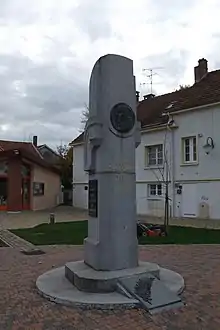
tribute to Henri Guillaumet.
See also
References
- ↑ "Répertoire national des élus: les maires". data.gouv.fr, Plateforme ouverte des données publiques françaises (in French). 2 December 2020.
- ↑ "Populations légales 2020". The National Institute of Statistics and Economic Studies. 29 December 2022.
External links
Wikimedia Commons has media related to Bouy.
This article is issued from Wikipedia. The text is licensed under Creative Commons - Attribution - Sharealike. Additional terms may apply for the media files.