| Blackmon Peak | |
|---|---|
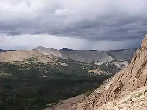 The light colored peak on the distant ridge. | |
| Highest point | |
| Elevation | 10,302 ft (3,140 m)[1] |
| Prominence | 400 ft (120 m)[2] |
| Parent peak | Castle Peak |
| Coordinates | 44°03′29″N 114°39′09″W / 44.0580935°N 114.6525264°W[1] |
| Geography | |
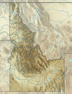 Blackmon Peak Custer County, Idaho, U.S. | |
| Parent range | White Cloud Mountains |
| Topo map | USGS Washington Peak |
| Climbing | |
| Easiest route | Simple scrambling, class 2 |
Blackmon Peak, also known as Blackman Peak, at 10,302 feet (3,140 m) above sea level is a peak in the White Cloud Mountains of Idaho.[1] The peak is located in Sawtooth National Recreation Area in Custer County 2.11 mi (3.40 km) from Castle Peak, its line parent.[3][4][5] It is named for George Blackmon (b.1854), freed slave and mining pioneer.[1]
See also
References
- 1 2 3 4 "Blackmon Peak". Geographic Names Information System. United States Geological Survey, United States Department of the Interior. Retrieved January 12, 2013.
- ↑ "Blackman Peak". Lists of John. Retrieved January 12, 2013.
- ↑ Sawtooth National Forest (Map) (1998 ed.). Sawtooth National Forest, U.S. Forest Service.
- ↑ "Blackmon Peak". SummitPost.org. Retrieved January 12, 2013.
- ↑ "Blackman Peak". Peakbagger.com. Retrieved January 12, 2013.
This article is issued from Wikipedia. The text is licensed under Creative Commons - Attribution - Sharealike. Additional terms may apply for the media files.