Berd'huis | |
|---|---|
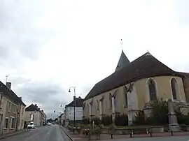 The church in Berd'huis | |
Location of Berd'huis | |
 Berd'huis  Berd'huis | |
| Coordinates: 48°20′46″N 0°44′48″E / 48.3461°N 0.7467°E | |
| Country | France |
| Region | Normandy |
| Department | Orne |
| Arrondissement | Mortagne-au-Perche |
| Canton | Bretoncelles |
| Government | |
| • Mayor (2020–2026) | Brigitte Luypaert[1] |
| Area 1 | 11.45 km2 (4.42 sq mi) |
| Population | 1,088 |
| • Density | 95/km2 (250/sq mi) |
| Time zone | UTC+01:00 (CET) |
| • Summer (DST) | UTC+02:00 (CEST) |
| INSEE/Postal code | 61043 /61340 |
| Elevation | 107–192 m (351–630 ft) (avg. 125 m or 410 ft) |
| 1 French Land Register data, which excludes lakes, ponds, glaciers > 1 km2 (0.386 sq mi or 247 acres) and river estuaries. | |
Berd'huis (French pronunciation: [bɛʁdɥi] ⓘ) is a commune in the Orne department in northwestern France.
Population
| Year | Pop. | ±% |
|---|---|---|
| 1962 | 517 | — |
| 1968 | 512 | −1.0% |
| 1975 | 564 | +10.2% |
| 1982 | 836 | +48.2% |
| 1990 | 1,003 | +20.0% |
| 1999 | 1,099 | +9.6% |
| 2006 | 1,077 | −2.0% |
| 2009 | 1,073 | −0.4% |
Notable buildings and places
National heritage sites
- Grand-Saint-Quentin Manor is a 16th century manor house declared as a Monument historique in 1974.[3]
See also
References
- ↑ "Répertoire national des élus: les maires". data.gouv.fr, Plateforme ouverte des données publiques françaises (in French). 2 December 2020.
- ↑ "Populations légales 2020". The National Institute of Statistics and Economic Studies. 29 December 2022.
- ↑ "Manoir du Grand-Saint-Quentin à Berd'huis - PA00110745". monumentum.fr.
Wikimedia Commons has media related to Berd'huis.
This article is issued from Wikipedia. The text is licensed under Creative Commons - Attribution - Sharealike. Additional terms may apply for the media files.