40°15′40″N 44°44′10″E / 40.26111°N 44.73611°E
Zar
Զառ | |
|---|---|
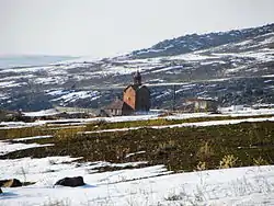 Surp Karapet Church in Zar | |
 Zar | |
| Coordinates: 40°15′40″N 44°44′10″E / 40.26111°N 44.73611°E | |
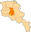
| Country | Armenia |
| Marz (Province) | Kotayk |
| Elevation | 1,750 m (5,740 ft) |
| Population (2008) | |
| • Total | 1,456 |
| Time zone | UTC+4 ( ) |
Zar (Armenian: Զառ), is a village in the Kotayk Province of Armenia.
See also
References
This article is issued from Wikipedia. The text is licensed under Creative Commons - Attribution - Sharealike. Additional terms may apply for the media files.