Wohlmirstedt | |
|---|---|
Location of Wohlmirstedt | |
 Wohlmirstedt 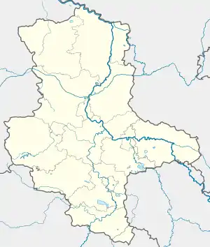 Wohlmirstedt | |
| Coordinates: 51°15′N 11°28′E / 51.250°N 11.467°E | |
| Country | Germany |
| State | Saxony-Anhalt |
| District | Burgenlandkreis |
| Town | Kaiserpfalz |
| Area | |
| • Total | 12.96 km2 (5.00 sq mi) |
| Elevation | 42 m (138 ft) |
| Population (2006-12-31) | |
| • Total | 944 |
| • Density | 73/km2 (190/sq mi) |
| Time zone | UTC+01:00 (CET) |
| • Summer (DST) | UTC+02:00 (CEST) |
| Postal codes | 06642 |
| Dialling codes | 034672 |
| Vehicle registration | BLK |
| Website | www.vgem-finne.de |
Wohlmirstedt is a village and a former municipality in the Burgenlandkreis district, in Saxony-Anhalt, Germany. Since 1 July 2009, it is part of the municipality Kaiserpfalz.
The first reference to Wohlmirstedt (Wolmerstede) is for 786. In 998 it came into possession of Memleben Abbey.[1]
Sights
- Protestant Church St. Maria Magdalena (early 16th century)
References
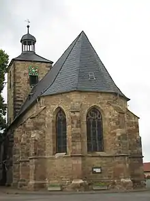
St. Maria Magdalena
This article is issued from Wikipedia. The text is licensed under Creative Commons - Attribution - Sharealike. Additional terms may apply for the media files.