| Winyaw River | |
|---|---|
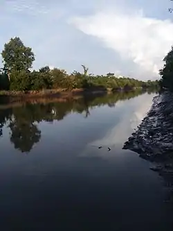 On the west bank of Winyaw River just after looking back towards transl. Kawankathaung. | |
| Native name | ဝင်းရော်မြစ် (Burmese) |
| Location | |
| Country | Myanmar |
| Physical characteristics | |
| Mouth | |
• location | Ataran River |
• coordinates | 27°46′16″N 85°25′38″E / 27.77111°N 85.42722°E |
• elevation | 17 m (56 ft) |
| Basin features | |
| Tributaries | |
| • left | Phabya Chaung,[1] Kyungawon Chaung[2] |
| Waterbodies | Tenasserim Range |
| Bridges | Winyaw-Seikkyi Bridge[3] |
The Winyaw River[4] (Burmese: ဝင်းရော်မြစ်) is a river in southern part of Myanmar. It originates in Tenasserim Range and empties into the Ataran River at the village of Chaunghanakwa.[5] Death Railway crosses the river near Anankwin village.[6][7]
See also
References
- ↑ Phabya Chaung (Approved) at GEOnet Names Server, United States National Geospatial-Intelligence Agency
- ↑ Kyungawon Chaung (Approved) at GEOnet Names Server, United States National Geospatial-Intelligence Agency
- ↑ Winyaw-Seikkyi Bridge
- ↑ Winyaw River (Approved) at GEOnet Names Server, United States National Geospatial-Intelligence Agency
- ↑ Chaunghanakwa Google Map
- ↑ Winyaw River Google Map
- ↑ "Burma 1:250,000 topographic map, Series U542, NE 47-14, Moulmein" U.S. Army May Service, December 1959
External links
- Winyaw River myanmar-law-library
15°55′04.8″N 97°58′20.0″E / 15.918000°N 97.972222°E
This article is issued from Wikipedia. The text is licensed under Creative Commons - Attribution - Sharealike. Additional terms may apply for the media files.