Trith-Saint-Léger | |
|---|---|
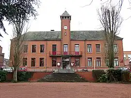 The town hall in Trith-Saint-Léger | |
 Coat of arms | |
Location of Trith-Saint-Léger | |
 Trith-Saint-Léger 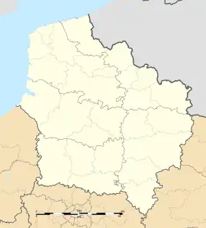 Trith-Saint-Léger | |
| Coordinates: 50°19′30″N 3°29′10″E / 50.325°N 3.486°E | |
| Country | France |
| Region | Hauts-de-France |
| Department | Nord |
| Arrondissement | Valenciennes |
| Canton | Aulnoy-lez-Valenciennes |
| Intercommunality | CA Porte du Hainaut |
| Government | |
| • Mayor (2020–2026) | Dominique Savary[1] |
| Area 1 | 6.87 km2 (2.65 sq mi) |
| Population | 6,186 |
| • Density | 900/km2 (2,300/sq mi) |
| Time zone | UTC+01:00 (CET) |
| • Summer (DST) | UTC+02:00 (CEST) |
| INSEE/Postal code | 59603 /59125 |
| Elevation | 21–81 m (69–266 ft) (avg. 25 m or 82 ft) |
| 1 French Land Register data, which excludes lakes, ponds, glaciers > 1 km2 (0.386 sq mi or 247 acres) and river estuaries. | |
Trith-Saint-Léger (French pronunciation: [tʁit sɛ̃ leʒe]) is a commune in the Nord department in northern France.[3]
Population
| Year | Pop. | ±% p.a. |
|---|---|---|
| 1968 | 7,612 | — |
| 1975 | 6,757 | −1.69% |
| 1982 | 5,952 | −1.80% |
| 1990 | 6,208 | +0.53% |
| 1999 | 6,196 | −0.02% |
| 2007 | 6,505 | +0.61% |
| 2012 | 6,393 | −0.35% |
| 2017 | 6,215 | −0.56% |
| Source: INSEE[4] | ||
Heraldry
Arms of Trith-Saint-Léger |
The arms of Trith-Saint-Léger are blazoned : Argent, a crescent gules.
|
See also
References
- ↑ "Répertoire national des élus: les maires". data.gouv.fr, Plateforme ouverte des données publiques françaises (in French). 9 August 2021.
- ↑ "Populations légales 2020". The National Institute of Statistics and Economic Studies. 29 December 2022.
- ↑ INSEE commune file
- ↑ Population en historique depuis 1968, INSEE
External links
Wikimedia Commons has media related to Trith-Saint-Léger.
This article is issued from Wikipedia. The text is licensed under Creative Commons - Attribution - Sharealike. Additional terms may apply for the media files.