| Tommy Wright Branch Tributary to Marshyhope Creek | |
|---|---|
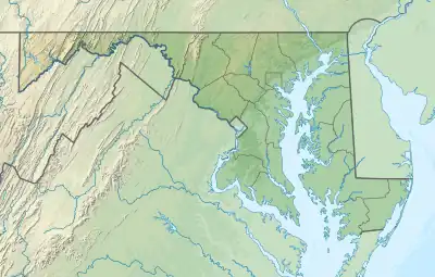 Location of Tommy Wright Branch mouth  Tommy Wright Branch (the United States) | |
| Location | |
| Country | United States |
| State | Maryland |
| County | Caroline |
| Physical characteristics | |
| Source | Mill Creek divide |
| • location | about 0.75 miles north-northeast of Concord, Maryland |
| • coordinates | 38°48′47.41″N 075°46′48.76″W / 38.8131694°N 75.7802111°W[1] |
| • elevation | 55 ft (17 m)[1] |
| Mouth | Marshyhope Creek |
• location | about 2.5 miles southwest of Smithville, Maryland[1] |
• coordinates | 38°45′30.41″N 075°44′19.75″W / 38.7584472°N 75.7388194°W[1] |
• elevation | 16 ft (4.9 m)[1] |
| Length | 5.99 mi (9.64 km)[2] |
| Basin size | 12.56 square miles (32.5 km2)[3] |
| Discharge | |
| • location | Marshyhope Creek |
| • average | 14.73 cu ft/s (0.417 m3/s) at mouth with Marshyhope Creek[3] |
| Basin features | |
| Progression | Marshyhope Creek → Nanticoke River → Chesapeake Bay → Atlantic Ocean |
| River system | Nanticoke River |
| Tributaries | |
| • left | Smithville Ditch |
| • right | unnamed tributaries |
| Waterbodies | Smithville Lake |
| Bridges | Trice Road, Possum Hill Road, Bloomery Road |
Tommy Wright Branch is a 5.99 mi (9.64 km) long third-order tributary to Marshyhope Creek in Caroline County, Maryland. This is the only stream of this name in the United States.[1]
Course
Tommy Wright Branch rises about 0.75 miles (1.21 km) north-northeast of Concord, Maryland and then flows southeast and turns southwest to join Marshyhope Creek about 2 miles (3.2 km) southwest of Smithville, Maryland.[1]
Watershed
Tommy Wright Branch drains 12.56 square miles (32.5 km2) of area, receives about 44.6 in/year of precipitation, and is about 11.68% forested.[3]
See also
References
- 1 2 3 4 5 6 7 "Geographic Names Information System". edits.nationalmap.gov. US Geological Survey. Retrieved December 9, 2022.
- ↑ "ArcGIS Web Application". epa.maps.arcgis.com. US EPA. Retrieved December 9, 2022.
- 1 2 3 "Tommy Wright Branch Watershed Report". watersgeo.epa.gov. US EPA. Retrieved December 9, 2022.
This article is issued from Wikipedia. The text is licensed under Creative Commons - Attribution - Sharealike. Additional terms may apply for the media files.