City of Tenente Portela | |
|---|---|
 | |
 Flag  Seal | |
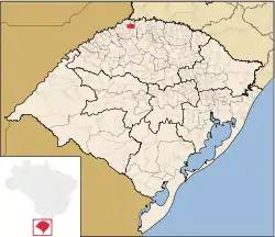 Geograpichal divisions of Rio Grande do Sul. Tenente Portela is highlighted in red. | |
| Coordinates: 27°22′15″S 53°45′28″W / 27.37083°S 53.75778°W | |
| Country | Brazil |
| State | Rio Grande do Sul |
| Incorporated | August 18, 1955 |
| Government | |
| • Mayor | Rubens Antonio Marroni Furini |
| Area | |
| • Total | 337.498 km2 (130.309 sq mi) |
| Elevation | 390 m (1,280 ft) |
| Population (2020 [1]) | |
| • Total | 13,434 |
| • Density | 39.5/km2 (102/sq mi) |
| Time zone | UTC−3 (BRT) |
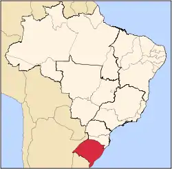
Tenente Portela is a city in the north-west region of Rio Grande do Sul, the southernmost state of Brazil, with an estimated population of 13,434 inhabitants. The city's geographical coordinates are 27°22′16″S 53°45′30″W / 27.37111°S 53.75833°W, and its elevation is 390 m. Area: 337.5 km².
References
External links
This article is issued from Wikipedia. The text is licensed under Creative Commons - Attribution - Sharealike. Additional terms may apply for the media files.