Tauxigny | |
|---|---|
Part of Tauxigny-Saint-Bauld | |
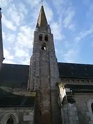 The church in Tauxigny | |
.svg.png.webp) Coat of arms | |
Location of Tauxigny | |
 Tauxigny  Tauxigny | |
| Coordinates: 47°12′53″N 0°50′07″E / 47.2147°N 0.8353°E | |
| Country | France |
| Region | Centre-Val de Loire |
| Department | Indre-et-Loire |
| Arrondissement | Loches |
| Canton | Loches |
| Commune | Tauxigny-Saint-Bauld |
| Area 1 | 36.83 km2 (14.22 sq mi) |
| Population (2015)[1] | 1,403 |
| • Density | 38/km2 (99/sq mi) |
| Time zone | UTC+01:00 (CET) |
| • Summer (DST) | UTC+02:00 (CEST) |
| Postal code | 37310 |
| Elevation | 67–114 m (220–374 ft) |
| 1 French Land Register data, which excludes lakes, ponds, glaciers > 1 km2 (0.386 sq mi or 247 acres) and river estuaries. | |
Tauxigny (French pronunciation: [toksiɲi]) is a former commune in the Indre-et-Loire department in central France. On 1 January 2018, it was merged into the new commune of Tauxigny-Saint-Bauld.[2]
Population
|
|
See also
References
- ↑ Téléchargement du fichier d'ensemble des populations légales en 2015, INSEE
- ↑ Arrêté préfectoral 11 September 2017 (in French)
Wikimedia Commons has media related to Tauxigny.
This article is issued from Wikipedia. The text is licensed under Creative Commons - Attribution - Sharealike. Additional terms may apply for the media files.