Talğar | |
|---|---|
District | |
| Талғар ауданы | |
 | |
| Coordinates: 43°18′55″N 77°14′35″E / 43.31528°N 77.24306°E | |
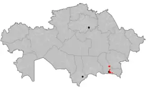
| Country | Kazakhstan |
| Region | Almaty Region |
| Administrative center | Talgar |
| Founded | 1969 |
| Government | |
| • Akim | Tanat Aidarbekov[1] |
| Area | |
| • Total | 1,400 sq mi (3,700 km2) |
| Population (2013)[2] | |
| • Total | 184,834 |
| Time zone | UTC+6 (East) |
Talğar District (Kazakh: Талғар ауданы, Talğar audany) is a district of Almaty Region in Kazakhstan. The administrative center of the district is the town of Talǵar.[3] It consists of an alluvial apron formed by the Talgar River, extending northwards from the glacier peaks of the Trans-Ili Alatau (topped by Talgar Peak, 4,973 m), an extension of the northern flanks of the Tien Shan Mountains. Population: 184,834 (2013 estimate);[2] 170,221 (2009 Census results);[4] 132,692 (1999 Census results).[4]
List of settlements
References
- ↑ "Танат Айдарбеков назначен акимом Талгарского района Алматинской области". www.inform.kz (in Russian). 2023-01-17.
- 1 2 "Население Республики Казахстан" (in Russian). Департамент социальной и демографической статистики. Retrieved 27 December 2013.
- ↑ www.geonames.de Subdivisions of Kazakhstan in local languages
- 1 2 "Население Республики Казахстан" [Population of the Republic of Kazakhstan] (in Russian). Департамент социальной и демографической статистики. Retrieved 8 December 2013.
This article is issued from Wikipedia. The text is licensed under Creative Commons - Attribution - Sharealike. Additional terms may apply for the media files.