Sylhet region
ꠍꠤꠟꠐ | |
|---|---|
| Nickname: জালালাবাদ | |
 বৃহত্তর সিলেট অঞ্চল | |
| countrys | |
| area | Bangladesh India |
| Area | |
| • Total | 18,738.4 km2 (7,234.9 sq mi) |
| Population (2011) | |
| • Total | 13,522,872 |
| • Density | 720/km2 (1,900/sq mi) |
| (Sylhet Division and Barak Velly's people) | |
| Demonym | Sylheti |
| Time zones | UTC+6 (BST) |
| UTC+05:30 (IST) | |
| language | Sylheti |
| other languages | Bengali, Assamese, Khasi, Kuki, Meitei, Bishnupriya Manipuri, Garo, Tripuri |
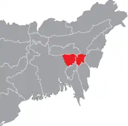
Sylhet region (Sylheti: ꠍꠤꠟꠐ), is a geographical, historical, and cultural region located in the eastern part of the Indian subcontinent and consists of the Sylhet Division of Bangladesh, which includes the Surma Valley and three districts of the Barak Valley in the Indian state of Assam. In 1947, a referendum was held in Sylhet. According to the results of the referendum, Sylhet decided to join the Pakistani province of East Bengal. When the Radcliffe Line was drawn, the Barak Valley was given to India by the commission, calling on a delegation led by Abdul Matlib Majumder. Nihar Ranjan Roy, author of the book History of Bengalis, said that South Assam/North-East Bengal or the Barak Valley is extended from the larger Surma/Meghna Valley of Bengal in every aspect, from culture to geography. [1]
References
- ↑ Ray, Niharranjan (1980-01-01). Bangalir itihas (in Bengali). Paschimbanga Samiti.