| Sugar Loaf | |
|---|---|
 | |
| Highest point | |
| Listing | Marilyn |
| Coordinates | 52°04′16″N 3°42′07″W / 52.071°N 3.702°W |
| Geography | |
| Location | Carmarthenshire, Wales |
| OS grid | SN834427 |
| Topo map | OS Explorer 187 |
| Climbing | |
| Easiest route | car park 400 m NE |
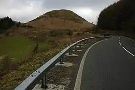
Sugar Loaf, sometimes called The Sugar Loaf, is a prominent hill in Carmarthenshire, Wales beside the A483 trunk road some four miles (six kilometres) south-west of Llanwrtyd Wells. It is a popular viewpoint and picnic spot within easy reach on foot from the roadside car parks to the northeast and to the south. There is a stop on the nearby Heart of Wales Line called Sugar Loaf railway station.
The name Sugar Loaf has been applied to numerous hills which have a perceived resemblance to a sugarloaf; the nearest is the Sugar Loaf on the border between Powys and Monmouthshire.[1]
External links
References
This article is issued from Wikipedia. The text is licensed under Creative Commons - Attribution - Sharealike. Additional terms may apply for the media files.