Starohnativka
Старогнатівка | |
|---|---|
Village | |
 Coat of arms | |
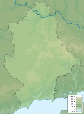 Starohnativka Location of Starohnativka within Ukraine 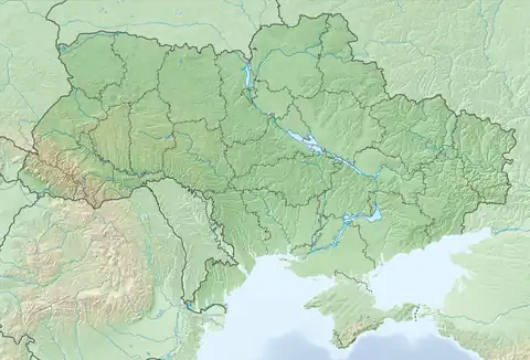 Starohnativka Starohnativka (Ukraine) | |
| Coordinates: 47°32′28″N 37°46′48″E / 47.54111°N 37.78000°E | |
| Country | Ukraine |
| Province | Donetsk Oblast |
| District | Volnovakha Raion |
| Founded | 1772 |
| Area | |
| • Total | 8.4 km2 (3.2 sq mi) |
| Elevation | 99 m (325 ft) |
| Population | |
| • Total | 2,031 |
| • Density | 240/km2 (630/sq mi) |
| Time zone | UTC+2 (EET) |
| • Summer (DST) | UTC+3 (EEST) |
| Postal code | 87110 |
| Area code | +380 6279 |
Starohnativka (Ukrainian: Старогнатівка; Urum: Ґӱрджи; Russian: Старогнатовка) is a village in Volnovakha Raion (district) in Donetsk Oblast of eastern Ukraine, 65.9 km south from the centre of Donetsk city.
Demographics
Native language as of the Ukrainian Census of 2001:[1]
References
- 1 2 "Офіційна сторінка Всеукраїнського перепису населення | Банк даних" [All-Ukrainian population census | Database]. ukrcensus.gov.ua (in Ukrainian). Retrieved 23 August 2023.
External links
![]() Media related to Starohnativka at Wikimedia Commons
Media related to Starohnativka at Wikimedia Commons
Media coverage during the War in Donbas
- Ukraine reports heaviest shelling by eastern rebels since February, Reuters, 10 August 2015
- Jack Losh, Ukraine's Mystery Battle: Hunting for Truths Across an Elastic Border, Vice News, 17 August 2015
This article is issued from Wikipedia. The text is licensed under Creative Commons - Attribution - Sharealike. Additional terms may apply for the media files.