St. Catharine, Missouri | |
|---|---|
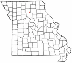 Location of St. Catharine in Missouri | |
| Coordinates: 39°47′42″N 92°59′40″W / 39.79500°N 92.99444°W | |
| Country | United States |
| State | Missouri |
| County | Linn |
| Area | |
| • Total | 0.74 sq mi (1.91 km2) |
| • Land | 0.73 sq mi (1.90 km2) |
| • Water | 0.00 sq mi (0.01 km2) |
| Elevation | 830 ft (250 m) |
| Population (2020) | |
| • Total | 78 |
| • Density | 106.41/sq mi (41.08/km2) |
| FIPS code | 29-64046 |
| GNIS feature ID | 2587111[2] |
Saint Catharine or St. Catharine is an unincorporated community and census-designated place in southeast Linn County, Missouri, United States.[2] Saint Catharine is located approximately four miles east of Brookfield on Missouri Route 11. The Chicago, Burlington and Quincy Railroad passes the south side of the community.[3]
St. Catharine was founded in 1856, and is not named for Catherine of Alexandria, but instead for Mrs. Catherine Elliot, by her husband, William Elliot.[4] A post office called Saint Catherine was established in 1859, and remained in operation until 1993.[5]
Demographics
| Census | Pop. | Note | %± |
|---|---|---|---|
| 2020 | 78 | — | |
| U.S. Decennial Census[6] | |||
References
- ↑ "ArcGIS REST Services Directory". United States Census Bureau. Retrieved September 5, 2022.
- 1 2 3 U.S. Geological Survey Geographic Names Information System: St. Catharine, Missouri
- ↑ Bucklin, MO, 7.5 Minute Topographic Quadrangle, USGS, 1949
- ↑ Eaton, David Wolfe (1916). How Missouri Counties, Towns and Streams Were Named. The State Historical Society of Missouri. pp. 188.
- ↑ "Post Offices". Jim Forte Postal History. Retrieved October 29, 2016.
- ↑ "Census of Population and Housing". Census.gov. Retrieved June 4, 2016.
Municipalities and communities of Linn County, Missouri, United States | ||
|---|---|---|
| Cities | 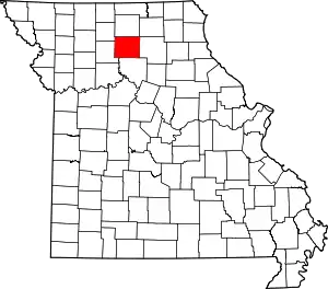 Map of Missouri highlighting Linn County | |
| Townships |
| |
| CDP | ||
| Other communities | ||
| Footnotes | ‡This populated place also has portions in an adjacent county or counties | |
This article is issued from Wikipedia. The text is licensed under Creative Commons - Attribution - Sharealike. Additional terms may apply for the media files.