Soanindrariny | |
|---|---|
 Soanindrariny | |
 Soanindrariny Location in Madagascar | |
| Coordinates: 19°54′S 47°14′E / 19.900°S 47.233°E | |
| Country | |
| Region | Vakinankaratra |
| District | Antsirabe II |
| Elevation | 1,788 m (5,866 ft) |
| Population (2001)[2] | |
| • Total | 21,000 |
| • Ethnicities | Merina |
| Time zone | UTC3 (EAT) |
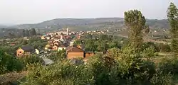
Soanindrariny is a rural municipality in Madagascar. It belongs to the district of Antsirabe II, which is a part of Vakinankaratra Region. The population of the commune was estimated to be approximately 21,000 in the 2001 commune census.[2]
Primary and junior level secondary education are available in town. The majority 95% of the population of the commune are farmers, while an additional 5% receives their livelihood from raising livestock. The most important crops are rice and fruits, while other important agricultural products are maize and potatoes.[2]
Roads
Soanindrariny is situated at 22 km east of Antsirabe with which it is connnected by an unpaved Provincial road 122 , and to the north to Antanifotsy by the Provincial road 111.[3]
References
- ↑ Estimated based on DEM data from Shuttle Radar Topography Mission
- 1 2 3 "ILO census data". Cornell University. 2002. Retrieved 2008-04-22.
- ↑ Roads in Vakinaratra
19°54′S 47°14′E / 19.900°S 47.233°E
Capital: Antsirabe | ||
| Ambatolampy (19) | 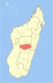 | |
| Antanifotsy (14) | ||
| Antsirabe I (1) | ||
| Antsirabe II (20) | ||
| Betafo (18) | ||
| Faratsiho (9) | ||
| Mandoto (9) | ||
7 districts; 89 communes | ||