Sandar Municipality
Sandar herred | |
|---|---|
| Sandeherad herred (historic name) Sandeherred herred [1] (historic name) | |
 | |
 Vestfold within Norway | |
 Sandar within Vestfold | |
| Coordinates: 59°08′03″N 10°13′28″E / 59.1343°N 10.2244°E | |
| Country | Norway |
| County | Vestfold |
| District | Vestfold |
| Established | 1 Jan 1838 |
| • Created as | Formannskapsdistrikt |
| Disestablished | 1 Jan 1968 |
| • Succeeded by | Sandefjord Municipality |
| Administrative centre | Sandar |
| Area (upon dissolution) | |
| • Total | 120 km2 (50 sq mi) |
| Population (1968) | |
| • Total | 24,898 |
| • Density | 210/km2 (540/sq mi) |
| Demonym | Sandehering[2] |
| Official language | |
| • Norwegian form | Bokmål[4] |
| Time zone | UTC+01:00 (CET) |
| • Summer (DST) | UTC+02:00 (CEST) |
| ISO 3166 code | NO-0724[5] |
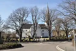
Sandar (or historically Sandeherred) is a former municipality in Vestfold county, Norway. The 120-square-kilometre (46 sq mi)[6][1] municipality existed from 1838 until its dissolution in 1968. The area is now part of Sandefjord Municipality. The administrative centre was located at Sandar, right by the Sandar Church in what is now the town of Sandefjord.[6]
Sandar was located in the southern, coastal part of Vestfold county. The European route E18 highway and the Vestfoldbanen railway line both passed through the municipality. The municipality encircled the whole town of Sandefjord until 1968 when they were merged.[6]
History
The parish of Sandeherred (later spelled Sandar) was established as a municipality on 1 January 1838 (see formannskapsdistrikt law). The original municipality encircled the growing town of Sandefjord. On 1 January 1889, an area of Sandeherred (population: 318) was annexed and became part of the town of Sandefjord. In 1931, another area of Sandeherred (population: 66) was transferred to the town of Sandefjord. In 1950, another area of Sandar (population: 226) was transferred to the town of Sandefjord. During the 1960s, there were many municipal mergers across Norway due to the work of the Schei Committee. On 1 January 1968, Sandar Municipality (population: 24,898) was merged with the neighboring town of Sandefjord (population: 6,242) to form a new, larger Sandefjord Municipality.[7]
During its existence, Sandar was basically the rural area surrounding an urban town. It had its share of industry, mostly located close to the town border. Many famous corporations now associated with Sandefjord had their origins in Sandar including Jotun, Framnæs Mekaniske Værksted and Sandar Fabrikker (a chemical plant dedicated to refining whale oil).[8]
Name
The municipality (originally the parish) was originally named Sandeherred. The name came from the old Sande farm (Old Norse: Sandar) since the first Sandar Church was built there. The first element is the plural form of sandr which means "sand" or "sandbanks". The last element was added later. It was derived from the old word herað which means "district" or "municipality".[9]
Historically, the name of the municipality was spelled Sandeherred. On 3 November 1917, a royal resolution changed the spelling of the name of the municipality to Sandeherad.[10] On 13 March 1931, a royal resolution changed the name of the municipality to Sandar, the original Old Norse name for the old farm.[11]
See also
References
- 1 2 Helland, Amund (1915). "Sandeherred herred". VII. Jarlsberg og Larvik Amt. Tredie del. Norges land og folk (in Norwegian). Vol. 3. Kristiania, Norway: H. Aschehoug & Company. p. 575. Retrieved 17 November 2023.
- ↑ "Navn på steder og personer: Innbyggjarnamn" (in Norwegian). Språkrådet.
- ↑ "Forskrift om målvedtak i kommunar og fylkeskommunar" (in Norwegian). Lovdata.no.
- ↑ "Norsk Lovtidende. 2den Afdeling. 1932. Samling af Love, Resolutioner m.m". Norsk Lovtidend (in Norwegian). Oslo, Norway: Grøndahl og Søns Boktrykkeri: 453–471. 1932.
- ↑ Bolstad, Erik; Thorsnæs, Geir, eds. (26 January 2023). "Kommunenummer". Store norske leksikon (in Norwegian). Kunnskapsforlaget.
- 1 2 3 Thorsnæs, Geir, ed. (28 June 2022). "Sandar". Store norske leksikon (in Norwegian). Kunnskapsforlaget. Retrieved 17 November 2023.
- ↑ Jukvam, Dag (1999). "Historisk oversikt over endringer i kommune- og fylkesinndelingen" (PDF) (in Norwegian). Statistisk sentralbyrå. ISBN 9788253746845.
- ↑ Berg, Lorens (1918). Bygdebok for Sandeherred (in Norwegian). Kristiania, Norge: Olaf Norlis Forlag.
- ↑ Rygh, Oluf (1907). Norske gaardnavne: Jarlsberg og Larviks amt (in Norwegian) (6 ed.). Kristiania, Norge: W. C. Fabritius & sønners bogtrikkeri. p. 260.
- ↑ "Norsk Lovtidende. 2den Afdeling. 1917. Samling af Love, Resolutioner m.m". Norsk Lovtidend (in Norwegian). Kristiania, Norge: Grøndahl og Søns Boktrykkeri: 1057–1065. 1917.
- ↑ "Norsk Lovtidende. 2den Afdeling. 1931. Samling af Love, Resolutioner m.m". Norsk Lovtidend (in Norwegian). Oslo, Norway: Grøndahl og Søns Boktrykkeri: 61. 1931.
Vestfold og Telemark county, Norway | |||||||||
|---|---|---|---|---|---|---|---|---|---|
| |||||||||
 | Towns and cities |
|  | ||||||
| Municipalities |
| ||||||||