Salahley
Sallaxley | |
|---|---|
City | |
| Salahlay | |
|
Local council seal of Salahley | |
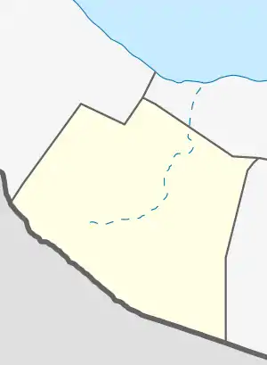 Salahley Location in Somaliland .svg.png.webp) Salahley Salahley (Somaliland) | |
| Coordinates: 9°01′36″N 44°12′26.9″E / 9.02667°N 44.207472°E | |
| Country | |
| Region | Marodi Jeh |
| District | Salahlay District |
| Government | |
| • Type | Council Government |
| • Mayor | Ahmed Buraale Iimaan (Heer-caalami) |
| Elevation | 1,215 m (3,986 ft) |
| Time zone | UTC+3 (EAT) |
| Area code | +252 |
Salahley (Somali: Sallaxley), (Arabic: سلحلي), is a town in the Maroodi Jeex region of Somaliland and is the seat of the Salahlay District. It is south of Hargeisa, the capital of the country.[1]
Location
The City located around 56 km southeast of Hargeisa and 15 km from the border with the Somali Region of Ethiopia.
Population
The majority of the district is inhabited by the Eidagale, which is The population estimation for the Salahley district has not been conducted yet, but it will be carried out in the upcoming years for the entire population. As soon as possible.
Climate
The climate in Salahley is called a desert climate. There is virtually no rainfall during the year. The climate here is classified as BWh by the Köppen-Geiger system. In Salaxley, the average annual temperature is 22.7 °C. About 367 mm of precipitation falls annually. The driest month is December. There is 1 mm of precipitation in December. In April, the precipitation reaches its peak, with an average of 72 mm. With an average of 24.7 °C, May is the warmest month. At 19.5 °C on average, January is the coldest month of the year. The precipitation varies 71 mm between the driest month and the wettest month. The variation in annual temperature is around 5.2 °C
| Climate data for Salaxley | |||||||||||||
|---|---|---|---|---|---|---|---|---|---|---|---|---|---|
| Month | Jan | Feb | Mar | Apr | May | Jun | Jul | Aug | Sep | Oct | Nov | Dec | Year |
| Average high °C (°F) | 27.4 (81.3) |
29 (84) |
30.8 (87.4) |
30.1 (86.2) |
31.4 (88.5) |
31.2 (88.2) |
29.2 (84.6) |
29.9 (85.8) |
31.6 (88.9) |
30.1 (86.2) |
28.3 (82.9) |
27.1 (80.8) |
29.7 (85.4) |
| Average low °C (°F) | 11.6 (52.9) |
13.3 (55.9) |
15.6 (60.1) |
16.9 (62.4) |
18 (64) |
18 (64) |
17.7 (63.9) |
17.8 (64.0) |
17.9 (64.2) |
15.5 (59.9) |
13.6 (56.5) |
12.6 (54.7) |
15.7 (60.2) |
| Average precipitation mm (inches) | 3 (0.1) |
4 (0.2) |
26 (1.0) |
72 (2.8) |
65 (2.6) |
29 (1.1) |
29 (1.1) |
41 (1.6) |
54 (2.1) |
34 (1.3) |
9 (0.4) |
1 (0.0) |
367 (14.3) |
| Source: Climate-Data.org,[2] | |||||||||||||
See also
References
- ↑ "Countries That Aren't Really Countries".
- ↑ "Climate: Salaxley- Climate graph, Temperature graph, Climate table". Retrieved 17 November 2019.
https://en.climate-data.org/africa/somalia/woqooyi-galbeed/salaxley-643964