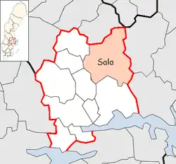
Sala Municipality
Sala kommun | |
|---|---|
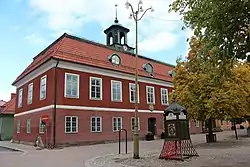 Sala Town Hall | |
 Coat of arms | |
 | |
| Coordinates: 59°55′N 16°36′E / 59.917°N 16.600°E | |
| Country | Sweden |
| County | Västmanland County |
| Seat | Sala |
| Area | |
| • Total | 1,204.39 km2 (465.02 sq mi) |
| • Land | 1,166.85 km2 (450.52 sq mi) |
| • Water | 37.54 km2 (14.49 sq mi) |
| Area as of 1 January 2014. | |
| Population (31 December 2021)[2] | |
| • Total | 22,998 |
| • Density | 19/km2 (49/sq mi) |
| Time zone | UTC+1 (CET) |
| • Summer (DST) | UTC+2 (CEST) |
| ISO 3166 code | SE |
| Province | Västmanland and Uppland |
| Municipal code | 1981 |
| Website | www.sala.se |
Sala Municipality (Swedish: Sala kommun) is a municipality in Västmanland County in central Sweden. Its seat is located in the city of Sala.
The present municipality was created in 1971, when the City of Sala was amalgamated with the rural municipalities Möklinta and Tärna and a part of Västerfärnebo.
Localities
- Kila
- Kumla kyrkby
- Möklinta
- Norrbäck
- Ransta
- Sala (seat)
- Salbohed
- Sätra brunn
- Västerfärnebo
See also
References
- ↑ "Statistiska centralbyrån, Kommunarealer den 1 januari 2014" (in Swedish). Statistics Sweden. 2014-01-01. Archived from the original (Microsoft Excel) on 2016-09-27. Retrieved 2014-04-18.
- ↑ "Folkmängd i riket, län och kommuner 31 december 2021" (in Swedish). Statistics Sweden. February 22, 2022. Retrieved February 22, 2022.
External links
 Media related to Sala Municipality, Sweden at Wikimedia Commons
- Sala Municipality website
Places adjacent to Sala Municipality, Sweden | |
|---|---|
Municipalities and seats of Västmanland County | ||
|---|---|---|
| Municipalities | ||
| Municipal seats | ||
This article is issued from Wikipedia. The text is licensed under Creative Commons - Attribution - Sharealike. Additional terms may apply for the media files.