Sainte-Suzanne | |
|---|---|
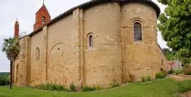 The church in Sainte-Suzanne | |
Location of Sainte-Suzanne | |
 Sainte-Suzanne  Sainte-Suzanne | |
| Coordinates: 43°12′40″N 1°23′14″E / 43.2111°N 1.3872°E | |
| Country | France |
| Region | Occitania |
| Department | Ariège |
| Arrondissement | Saint-Girons |
| Canton | Arize-Lèze |
| Government | |
| • Mayor (2020–2026) | Elisabeth Albero[1] |
| Area 1 | 10.39 km2 (4.01 sq mi) |
| Population | 238 |
| • Density | 23/km2 (59/sq mi) |
| Time zone | UTC+01:00 (CET) |
| • Summer (DST) | UTC+02:00 (CEST) |
| INSEE/Postal code | 09342 /09130 |
| Elevation | 220–361 m (722–1,184 ft) (avg. 290 m or 950 ft) |
| 1 French Land Register data, which excludes lakes, ponds, glaciers > 1 km2 (0.386 sq mi or 247 acres) and river estuaries. | |
Sainte-Suzanne (French pronunciation: [sɛ̃t syzan]; Occitan: Senta Susana) is a commune in the Ariège department in southwestern France.
Geography
The Lèze flows north through the middle of the commune and crosses the village.
Population
Inhabitants Sainte-Suzanne are called Sainte-Suzannois.
| Year | Pop. | ±% |
|---|---|---|
| 1962 | 224 | — |
| 1968 | 233 | +4.0% |
| 1975 | 224 | −3.9% |
| 1982 | 190 | −15.2% |
| 1990 | 174 | −8.4% |
| 1999 | 192 | +10.3% |
| 2008 | 242 | +26.0% |
See also
References
- ↑ "Répertoire national des élus: les maires". data.gouv.fr, Plateforme ouverte des données publiques françaises (in French). 9 August 2021.
- ↑ "Populations légales 2020". The National Institute of Statistics and Economic Studies. 29 December 2022.
Wikimedia Commons has media related to Sainte-Suzanne (Ariège).
This article is issued from Wikipedia. The text is licensed under Creative Commons - Attribution - Sharealike. Additional terms may apply for the media files.