Saint-Pierre-de-Chandieu | |
|---|---|
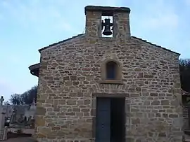 Chapel of St. Thomas | |
.svg.png.webp) Coat of arms | |
Location of Saint-Pierre-de-Chandieu | |
 Saint-Pierre-de-Chandieu  Saint-Pierre-de-Chandieu | |
| Coordinates: 45°38′50″N 5°00′56″E / 45.6472°N 5.0156°E | |
| Country | France |
| Region | Auvergne-Rhône-Alpes |
| Department | Rhône |
| Arrondissement | Lyon |
| Canton | Genas |
| Intercommunality | CC de l'Est lyonnais |
| Government | |
| • Mayor (2020–2026) | Raphaël Ibanez[1] |
| Area 1 | 29.28 km2 (11.31 sq mi) |
| Population | 4,616 |
| • Density | 160/km2 (410/sq mi) |
| Time zone | UTC+01:00 (CET) |
| • Summer (DST) | UTC+02:00 (CEST) |
| INSEE/Postal code | 69289 /69780 |
| Elevation | 215–369 m (705–1,211 ft) (avg. 365 m or 1,198 ft) |
| 1 French Land Register data, which excludes lakes, ponds, glaciers > 1 km2 (0.386 sq mi or 247 acres) and river estuaries. | |
Saint-Pierre-de-Chandieu (French pronunciation: [sɛ̃ pjɛʁ də ʃɑ̃djø]) is a commune in the Rhône department in eastern France.
Population
| Year | Pop. | ±% p.a. |
|---|---|---|
| 1968 | 1,431 | — |
| 1975 | 2,314 | +7.11% |
| 1982 | 2,658 | +2.00% |
| 1990 | 3,523 | +3.58% |
| 1999 | 4,133 | +1.79% |
| 2007 | 4,407 | +0.81% |
| 2012 | 4,651 | +1.08% |
| 2017 | 4,520 | −0.57% |
| Source: INSEE[3] | ||
See also
References
- ↑ "Répertoire national des élus: les maires" (in French). data.gouv.fr, Plateforme ouverte des données publiques françaises. 13 September 2022.
- ↑ "Populations légales 2020". The National Institute of Statistics and Economic Studies. 29 December 2022.
- ↑ Population en historique depuis 1968, INSEE
Wikimedia Commons has media related to Saint-Pierre-de-Chandieu.
This article is issued from Wikipedia. The text is licensed under Creative Commons - Attribution - Sharealike. Additional terms may apply for the media files.