Saint-Paul | |
|---|---|
_02.JPG.webp) Saint-Paul's church | |
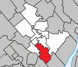 Location within Joliette RCM | |
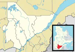 Saint-Paul Location in central Quebec | |
| Coordinates: 45°59′N 73°27′W / 45.983°N 73.450°W[1] | |
| Country | Canada |
| Province | Quebec |
| Region | Lanaudière |
| RCM | Joliette |
| Constituted | July 1, 1855 |
| Government | |
| • Mayor | Alain Bellemare |
| • Federal riding | Joliette |
| • Prov. riding | Joliette |
| Area | |
| • Total | 49.90 km2 (19.27 sq mi) |
| • Land | 49.11 km2 (18.96 sq mi) |
| Population (2021)[3] | |
| • Total | 6,566 |
| • Density | 133.7/km2 (346/sq mi) |
| • Pop 2016-2021 | |
| • Dwellings | 2,755 |
| Time zone | UTC−5 (EST) |
| • Summer (DST) | UTC−4 (EDT) |
| Postal code(s) | |
| Area code(s) | 450 and 579 |
| Highways | |
| Website | www.municipalite stpaul.qc.ca |
Saint-Paul is a municipality in the Lanaudière region of Quebec, Canada, part of the Joliette Regional County Municipality.
History
Saint-Paul was born in the northeast of the former Lordship of Lavaltrie. The first settlers, mainly from Saint-Pierre-du-Portage (L’Assomption) and Saint-Sulpice, cleared the territory gradually. First along the L’Assomption River around 1748, then on the coast of the Ouareau River around 1750 and on the Saint-Pierre stream around 1765. The population grew rapidly. Then, the territory was known as Saint-Paul-de-Lavaltrie
In 1855, the Parliament of United Canada passed the Lower Canada Municipalities and Roads Act to ensure the legal existence of many localities. That year, on July 1, a municipality was officially born under the name Conversion-de-Saint-Paul. In April 1922, the more urban sector of Conversion-de-Saint-Paul split away to form the new village municipality of Saint-Paul. That village changed its name seven years later to become the current village of Saint-Pierre. Meanwhile the rural Conversion-de-Saint-Paul would eventually change its name to only Saint-Paul, in 1954, to become the current municipality.
Demographics
Population trend:[4]
- Population in 2021: 6566 (2016 to 2021 population change: 11.5%)
- Population in 2016: 5891
- Population in 2011: 5122
- Population in 2006: 3987
- Population in 2001: 3616 (or 3606 with 2006 boundaries)
- Population in 1996: 3644
- Population in 1991: 3648
Private dwellings occupied by usual residents: 2701 (total dwellings: 2755)
Mother tongue:
- English as first language: 0.8%
- French as first language: 95.8%
- English and French as first language: 0.8%
- Other as first language: 1.9%
Education
Commission scolaire des Samares operates francophone public schools, including:
The Sir Wilfrid Laurier School Board operates anglophone public schools, including:
- Joliette Elementary School in Saint-Charles-Borromée[7]
- Joliette High School in Joliette[8]
The sole private school is operated by a cult, Mission de l'Esprit-Saint. It opened in 2016, following the foreclosure of the former illegal school, a decade ago :[9]
- École l'Accord[10]
See also
References
- ↑ "Banque de noms de lieux du Québec: Reference number 57403". toponymie.gouv.qc.ca (in French). Commission de toponymie du Québec.
- 1 2 "Répertoire des municipalités: Geographic code 61005". www.mamh.gouv.qc.ca (in French). Ministère des Affaires municipales et de l'Habitation.
- 1 2 Statistics Canada 2021 Census - Saint-Paul census profile
- ↑ Statistics Canada: 1996, 2001, 2006, 2011, 2016, 2021 census
- ↑ "La Passerelle (pavillon Notre-Dame-du-Sacré-Coeur)." Commission scolaire des Samares. Retrieved on September 23, 2017.
- ↑ "La Passerelle (pavillon Vert-Demain)." Commission scolaire des Samares. Retrieved on September 23, 2017.
- ↑ "JOLIETTE ELEMENTARY ZONE." Sir Wilfrid Laurier School Board. Retrieved on September 17, 2017.
- ↑ "Joliette High School Zone Sec 1-5." Sir Wilfrid Laurier School Board. Retrieved on September 5, 2017.
- ↑ " Québec autorise une école pour la Mission de l'Esprit-Saint" Retrieved on May 9, 2019.
- ↑ Official website ."Retrieved on May 9, 2019.
External links
 Media related to Saint-Paul, Quebec at Wikimedia Commons
Adjacent Municipal Subdivisions | ||||||||||||||||
|---|---|---|---|---|---|---|---|---|---|---|---|---|---|---|---|---|
| ||||||||||||||||
| Cities & Towns | |
|---|---|
| Municipalities | |
| Villages | |
| |