Saint-Martin-sous-Vigouroux | |
|---|---|
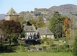 Chateau Lescure | |
 Coat of arms | |
Location of Saint-Martin-sous-Vigouroux | |
 Saint-Martin-sous-Vigouroux  Saint-Martin-sous-Vigouroux | |
| Coordinates: 44°55′26″N 2°48′13″E / 44.9239°N 2.8036°E | |
| Country | France |
| Region | Auvergne-Rhône-Alpes |
| Department | Cantal |
| Arrondissement | Saint-Flour |
| Canton | Saint-Flour-2 |
| Intercommunality | Saint-Flour Communauté |
| Government | |
| • Mayor (2020–2026) | Sophie Bénézit[1] |
| Area 1 | 19.29 km2 (7.45 sq mi) |
| Population | 223 |
| • Density | 12/km2 (30/sq mi) |
| Time zone | UTC+01:00 (CET) |
| • Summer (DST) | UTC+02:00 (CEST) |
| INSEE/Postal code | 15201 /15230 |
| Elevation | 670–1,371 m (2,198–4,498 ft) (avg. 742 m or 2,434 ft) |
| 1 French Land Register data, which excludes lakes, ponds, glaciers > 1 km2 (0.386 sq mi or 247 acres) and river estuaries. | |
Saint-Martin-sous-Vigouroux (French pronunciation: [sɛ̃ maʁtɛ̃ su viɡuʁu]; Auvergnat: Sant Martin jos Vigron) is a commune in the Cantal department in south-central France.
It is located at the southern tip of the 'Parc naturel régional des Volcans d'Auvergne' (Auvergne regional natural park).
Population
| Year | Pop. | ±% |
|---|---|---|
| 1962 | 354 | — |
| 1968 | 418 | +18.1% |
| 1975 | 410 | −1.9% |
| 1982 | 382 | −6.8% |
| 1990 | 357 | −6.5% |
| 1999 | 279 | −21.8% |
| 2008 | 260 | −6.8% |
| 2016 | 240 | −7.7% |
See also
References
- ↑ "Répertoire national des élus: les maires". data.gouv.fr, Plateforme ouverte des données publiques françaises (in French). 9 August 2021.
- ↑ "Populations légales 2020". The National Institute of Statistics and Economic Studies. 29 December 2022.
Wikimedia Commons has media related to Saint-Martin-sous-Vigouroux.
This article is issued from Wikipedia. The text is licensed under Creative Commons - Attribution - Sharealike. Additional terms may apply for the media files.