Saint-Juéry | |
|---|---|
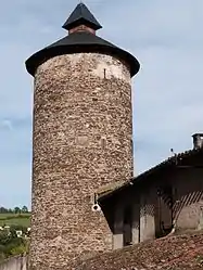 The tower of Avalats | |
Location of Saint-Juéry | |
 Saint-Juéry  Saint-Juéry | |
| Coordinates: 43°54′39″N 2°41′47″E / 43.9108°N 2.6964°E | |
| Country | France |
| Region | Occitania |
| Department | Aveyron |
| Arrondissement | Millau |
| Canton | Causses-Rougiers |
| Government | |
| • Mayor (2020–2026) | Thierry Roques[1] |
| Area 1 | 29.01 km2 (11.20 sq mi) |
| Population | 294 |
| • Density | 10/km2 (26/sq mi) |
| Time zone | UTC+01:00 (CET) |
| • Summer (DST) | UTC+02:00 (CEST) |
| INSEE/Postal code | 12233 /12550 |
| Elevation | 289–637 m (948–2,090 ft) (avg. 500 m or 1,600 ft) |
| 1 French Land Register data, which excludes lakes, ponds, glaciers > 1 km2 (0.386 sq mi or 247 acres) and river estuaries. | |
Saint-Juéry (French pronunciation: [sɛ̃ ʒɥeʁi]; Occitan: Sant Jòri) is a commune in the Aveyron department in southern France.
Population
| Year | Pop. | ±% |
|---|---|---|
| 1962 | 340 | — |
| 1968 | 396 | +16.5% |
| 1975 | 356 | −10.1% |
| 1982 | 322 | −9.6% |
| 1990 | 290 | −9.9% |
| 1999 | 257 | −11.4% |
| 2008 | 224 | −12.8% |
See also
References
- ↑ "Répertoire national des élus: les maires". data.gouv.fr, Plateforme ouverte des données publiques françaises (in French). 9 August 2021.
- ↑ "Populations légales 2020". The National Institute of Statistics and Economic Studies. 29 December 2022.
Wikimedia Commons has media related to Saint-Juéry (Aveyron).
This article is issued from Wikipedia. The text is licensed under Creative Commons - Attribution - Sharealike. Additional terms may apply for the media files.