Saint-Bauld | |
|---|---|
Part of Tauxigny-Saint-Bauld | |
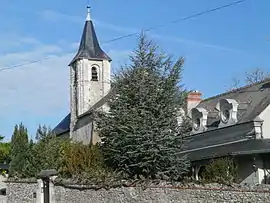 The church in Saint-Bauld | |
Location of Saint-Bauld | |
 Saint-Bauld  Saint-Bauld | |
| Coordinates: 47°10′51″N 0°50′17″E / 47.1808°N 0.8381°E | |
| Country | France |
| Region | Centre-Val de Loire |
| Department | Indre-et-Loire |
| Arrondissement | Loches |
| Canton | Loches |
| Commune | Tauxigny-Saint-Bauld |
| Area 1 | 4.11 km2 (1.59 sq mi) |
| Population (2019)[1] | 192 |
| • Density | 47/km2 (120/sq mi) |
| Time zone | UTC+01:00 (CET) |
| • Summer (DST) | UTC+02:00 (CEST) |
| Postal code | 37310 |
| Elevation | 77–103 m (253–338 ft) |
| 1 French Land Register data, which excludes lakes, ponds, glaciers > 1 km2 (0.386 sq mi or 247 acres) and river estuaries. | |
Saint-Bauld (French pronunciation: [sɛ̃ bo]) is a former commune in the Indre-et-Loire department in central France.[2] On 1 January 2018, it was merged into the new commune of Tauxigny-Saint-Bauld.[3]
Population
|
|
See also
References
- ↑ Téléchargement du fichier d'ensemble des populations légales en 2019, INSEE
- ↑ Des villages de Cassini aux communes d'aujourd'hui: Commune data sheet Saint-Bauld, EHESS (in French).
- ↑ Arrêté préfectoral 11 September 2017 (in French)
Wikimedia Commons has media related to Saint-Bauld.
This article is issued from Wikipedia. The text is licensed under Creative Commons - Attribution - Sharealike. Additional terms may apply for the media files.