Sé | |
|---|---|
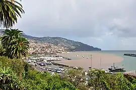 Central Funchal in the parish of Sé, looking towards the marina | |
 Coat of arms | |
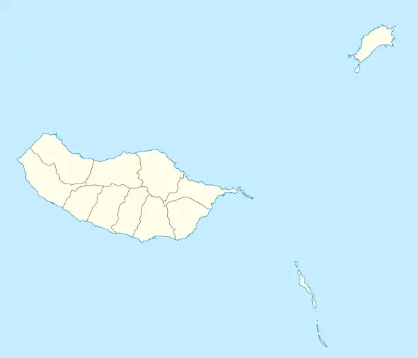 Sé Location in Madeira | |
| Coordinates: 32°38′46″N 16°54′51″W / 32.64611°N 16.91417°W | |
| Country | |
| Auton. region | Madeira |
| Island | Madeira |
| Municipality | Funchal |
| Established | Settlement: c. 1415 Parish: c. 1514 Civil parish: c. 1566 |
| Area | |
| • Total | 3.82 km2 (1.47 sq mi) |
| Elevation | 34 m (112 ft) |
| Population (2011) | |
| • Total | 2,656 |
| • Density | 700/km2 (1,800/sq mi) |
| Time zone | UTC±00:00 (WET) |
| • Summer (DST) | UTC+01:00 (WEST) |
| Postal code | 9050-443 |
| Area code | 291 |
Sé (Portuguese for "Episcopal see") is a civil parish in the municipality of Funchal, on the island of Madeira, Portugal. It includes the historical centre of Funchal. The population in 2011 was 2,656,[1] in an area of 3.82 km².[2] Its administrative authority includes the distant, uninhabited Savage Islands, with an area of 2.73 km².
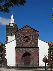
The Cathedral of Funchal, in the center of the Sé parish
References
This article is issued from Wikipedia. The text is licensed under Creative Commons - Attribution - Sharealike. Additional terms may apply for the media files.