| Ryesong River | |
|---|---|
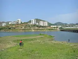 The Ryesong River flowing through Kumchon, North Hwanghae. | |
| Native name | 례성강 (Korean) |
| Location | |
| Country | North Korea |
| Physical characteristics | |
| Source | |
| • location | Ganghwa Bay |
| Mouth | |
• location | Mt. Eonjin |
| Length | 174 kilometers (108 mi)[1] |
| Basin size | 4,048 km2 (1,563 sq mi) |
| Ryesŏng River | |||||||
|---|---|---|---|---|---|---|---|
| North Korean name | |||||||
| Chosŏn'gŭl | 례성강 | ||||||
| Hancha | 禮成江 | ||||||
| |||||||
| South Korean name | |||||||
| Hangul | 예성강 | ||||||
| Hanja | 禮成江 | ||||||
| |||||||
The Ryesŏng River is a river of North Korea. It flows from north to south, emptying into the Yellow Sea by Ganghwa Island, just west of the mouth of the River Imjin.
See also
References
- ↑ 이재수 (2018). 《수문학》 2판. 구미서관. 70쪽. ISBN 9788982252914.
External links
- In Korean language online encyclopedias:
This article is issued from Wikipedia. The text is licensed under Creative Commons - Attribution - Sharealike. Additional terms may apply for the media files.