Rouvroy
Rouvrou (Gaumais) | |
|---|---|
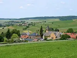 Torgny, southernmost place in Belgium | |
 Flag .svg.png.webp) Coat of arms | |
Location of Rouvroy | |
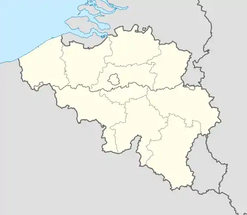 Rouvroy Location in Belgium
Location of Rouvroy in Luxembourg province 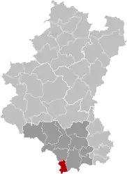 | |
| Coordinates: 49°32.3′N 5°29.45′E / 49.5383°N 5.49083°E | |
| Country | |
| Community | French Community |
| Region | Wallonia |
| Province | Luxembourg |
| Arrondissement | Virton |
| Government | |
| • Mayor | Carmen Ramlot |
| • Governing party/ies | GO |
| Area | |
| • Total | 28.1 km2 (10.8 sq mi) |
| Population (2018-01-01)[1] | |
| • Total | 2,082 |
| • Density | 74/km2 (190/sq mi) |
| Postal codes | 6767 |
| NIS code | 85047 |
| Area codes | 063 |
| Website | (in French) rouvroy.be |
Rouvroy (French pronunciation: [ʁuvʁwa]; Gaumais : Rouvrou; Walloon: Rovroe-e-Gåme) is a municipality of Wallonia located in the province of Luxembourg, Belgium.
On 1 January 2007 the municipality, which covers 27.68 km2, had 2,007 inhabitants, giving a population density of 72.5 inhabitants per km2. Wallonia and Belgium's southernmost point is situated in the municipality, at Torgny.
Formed in 1976, the municipality consists of the following district: Dampicourt, Harnoncourt, Lamorteau, Rouvroy, and Torgny. Other population centers include: Couvreux and Montquintin.
See also
References
- ↑ "Wettelijke Bevolking per gemeente op 1 januari 2018". Statbel. Retrieved 9 March 2019.
External links
 Media related to Rouvroy at Wikimedia Commons
Places adjacent to Rouvroy, Belgium | ||||||||||||||||
|---|---|---|---|---|---|---|---|---|---|---|---|---|---|---|---|---|
| ||||||||||||||||
Municipalities of the province of Luxembourg, Wallonia | ||
|---|---|---|
| Arlon | 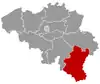 | |
| Bastogne | ||
| Marche-en-Famenne | ||
| Neufchâteau | ||
| Virton | ||
Bold indicates cities | ||
This article is issued from Wikipedia. The text is licensed under Creative Commons - Attribution - Sharealike. Additional terms may apply for the media files.