Riedlingsdorf | |
|---|---|
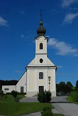 Catholic church in Riedlingsdorf | |
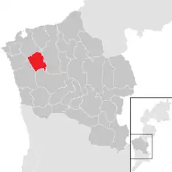 Location within Oberwart district | |
 Riedlingsdorf Location within Austria | |
| Coordinates: 47°21′N 16°8′E / 47.350°N 16.133°E | |
| Country | Austria |
| State | Burgenland |
| District | Oberwart |
| Government | |
| • Mayor | Erwin Kaipel |
| Area | |
| • Total | 16.13 km2 (6.23 sq mi) |
| Elevation | 317 m (1,040 ft) |
| Population (2018-01-01)[2] | |
| • Total | 1,619 |
| • Density | 100/km2 (260/sq mi) |
| Time zone | UTC+1 (CET) |
| • Summer (DST) | UTC+2 (CEST) |
| Postal code | 7422 |
Riedlingsdorf (Hungarian: Rödöny) is a municipality in Burgenland in the district Oberwart in Austria.
History
Until 1921 Riedlingsdorf belonged to Hungary, like the whole of Burgenland.
Population
| Year | Pop. | ±% |
|---|---|---|
| 1869 | 1,545 | — |
| 1880 | 1,514 | −2.0% |
| 1890 | 1,584 | +4.6% |
| 1900 | 1,666 | +5.2% |
| 1910 | 1,565 | −6.1% |
| 1923 | 1,485 | −5.1% |
| 1934 | 1,571 | +5.8% |
| 1939 | 1,544 | −1.7% |
| 1951 | 1,537 | −0.5% |
| 1961 | 1,549 | +0.8% |
| 1971 | 1,581 | +2.1% |
| 1981 | 1,569 | −0.8% |
| 1991 | 1,549 | −1.3% |
| 2001 | 1,633 | +5.4% |
| 2011 | 1,663 | +1.8% |
Politics
Of the 19 positions on the municipal council, the SPÖ has 14, the ÖVP 4, and the FPÖ 1.
References
- ↑ "Dauersiedlungsraum der Gemeinden Politischen Bezirke und Bundesländer - Gebietsstand 1.1.2018". Statistics Austria. Retrieved 10 March 2019.
- ↑ "Einwohnerzahl 1.1.2018 nach Gemeinden mit Status, Gebietsstand 1.1.2018". Statistics Austria. Retrieved 9 March 2019.
This article is issued from Wikipedia. The text is licensed under Creative Commons - Attribution - Sharealike. Additional terms may apply for the media files.