Rangia
Rangiya | |
|---|---|
City | |
| Rangia City | |
| Nickname(s): City of Colors, Transportation Hub of Assam, Plantation Valley of Assam, Gateway of Indo-Bhutan Border | |
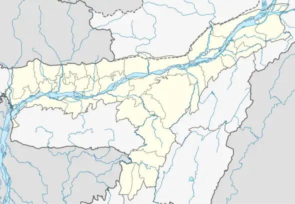 Rangia Location in Assam, India 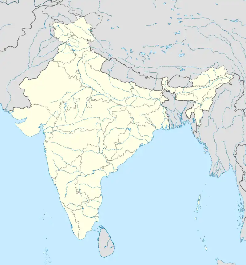 Rangia Rangia (India) | |
| Coordinates: 26°28′N 91°38′E / 26.47°N 91.63°E | |
| Country | |
| State | Assam |
| Region | Lower Assam |
| District | Kamrup |
| No. of Wards | 10 |
| District Office | Amingaon |
| Villages under Rangia Sub-District | Alagdia, Madhya Panduri, Athara Madhukuchi, Bala Gaon Arimatta, Balikuchi Padum Kowari, Bangaon Padum Kowari, Barhampur Hat Bajali, Jayontipur, Barkuriha Haradutta, Barlessakona, Madhukuchi, Barmurah, Batakuchi and 74 more... |
| Founded by | Government of Assam |
| Named for | Rangia Municipality Board |
| Government | |
| • Type | Municipality |
| • Body | Rangia Municipality Board |
| • Deputy Commissioner | Smti Keerthi Jalli, IAS |
| • MLA | Bhabesh Kalita (BJP) |
| Area | |
| • Total | 9.6 km2 (3.7 sq mi) |
| • Rank | 1st in Kamrup (R) District |
| Elevation | 39 m (128 ft) |
| Population (2011) | |
| • Total | 26,389 |
| • Rank | 16th |
| • Density | 2,700/km2 (7,100/sq mi) |
| • Climate | Cwa |
| Demonym | Rangian |
| Languages | |
| • Official | Assamese |
| • Native | Kamrupi |
| Time zone | UTC+5:30 (IST) |
| PIN | 781354 |
| Telephone code | 03621 |
| ISO 3166 code | IN-AS |
| Vehicle registration | AS 01 & AS 25 |
| Literacy | 71.4% (2011) |
| Sex ratio | 1.17:1 (male:female) ♂/♀ |
| Summer temperature | 30°C - 39°C |
| Winter temperature | 19°C - 29°C |
| Website | rangiamb |
Rangia (Pron: ˈræŋˌgɪə) is a plantation valley city and a municipal board located in the Kamrup Rural district of Assam, India. Rangia serves as the sub-district headquarter of Rangia Sub-district in Kamrup Rural District. One of Rangia's significant features is its role as the divisional headquarter of the Northeast Frontier Railway, which is one of the major railway zones in India.[1] Baralia river flows through the heart of the city. Bhabesh Kalita is the MLA of Rangia Assembly constituency. Rangiya Junction is the 4th Biggest Railway Station in North East. Rangia is the Largest city of the Kamrup Rural district. And Additionally, Rangia holds the distinction of being known as the gateway to the Indo-Bhutan border.[2]
The Redhorn Division of the Indian Army is located just three kilometers from the city. Assam's first train restaurant located at Rangia. Rangia ancient name is "Randiya". Rangia covers an area of 9.6 square kilometers and is divided into 10 wards where regular elections are conducted every 5 years.[3] The city is located approximately 52 kilometers away from the state headquarter Dispur (Guwahati), which is the capital of Assam and about 39 kilometers from Jalukbari, a prominent area in Guwahati.
Etymology
The word "Rangia" is believed to have been derived from the local term "Randiya". According to local folklore, "Ran" means 'war' and "Diya" means 'to give', indicating that Rangia was a place where a conflict or battle took place between the Boro people and Bhutanese communities.[4]
History
In Ancient times it was part of Ancient Kamrup, and subsequently included in Kamapitha division of Kamarupa Kingdom. In modern times, Rangiya is part of Kamrupi cultural region.
Geography
Rangiya is located at 26°28′N 91°38′E / 26.47°N 91.63°E.[5] It has an average elevation of 39 metres (128 feet). Rangia covers of area 9.6 square kilometres. The river Baralia flows through the heart of the city.
Politics
Assam has 126 assembly constituencies, and Rangiya Assembly constituency is one of these where voters elect their representative. Bhabesh Kalita is the MLA of Rangia Assembly constituency. It also falls under the Mangaldoi Lok Sabha constituency, which elects members to the national-level Lok Sabha.
Demographics
As of 2011 India census,[6] Rangiya had a population of 26,389. Males constitute 54% of the population and females 46%. Rangiya has an average literacy rate of 73%, higher than the national average of 59.5%: male literacy is 78%, and female literacy is 67%. In Rangiya, 12% of the population is under six years of age.
Sports
Rangia have 3 main gyms - Panther Gym Rangia, Saraighat Fitness Centre, Real Builders Gym.
Other Sports Centres - Taekwondo Coaching Centre Rangia, Badminton Court DRSC/Rangia, Rangia Cricket Academy, Rangia Cricket Association, Rangia College Indoor Stadium, Rangia Rhino Karate Club
Healthcare system
There are several private hospitals in Rangiya apart from 2 government hospitals. Some of them are Swasti Hospital (Estd. 2018),[7] Rangia Poly Clinic & Nursing Home, Sparsh Hospital (Estd. 2016).[8]
Transport
National Highway 27 runs through the heart of the city. Rangiya is important transit point in the region, nearly all trains halts at Rangiya Junction railway station. It is a junction of the New Bongaigaon–Guwahati section of Barauni–Guwahati line. Rangiya Junction is the 4th largest railway station in North-east India. It is one of the divisional headquarters of Northeast Frontier Railway. The Rangiya–Murkongselek line connects the state to Arunachal Pradesh.[9]
See also
References
- ↑ North East Frontier Railway: Rangia
- ↑ Rangia Municipal Board: About us
- ↑ Welcome To Rangia Municipal Board
- ↑ Siiger, Halfdan (2015). The Bodo of Assam: Revisiting a Classical Study from 1950 (PDF). NIAS Press. p. 183. ISBN 978-87-7694-160-4. Archived from the original (PDF) on 11 August 2020.
As the Bodos could not stand all this, in the long run they made war upon the Bhutanese. They fought in Rangia. Ron means war, and from that the town has got its name. There the Bodos were defeated by the Bhutanese. As they were defeated by the Bhutanese, the Bodos had to pay land revenue to them.
- ↑ Falling Rain Genomics, Inc - Rangia
- ↑ "Census of India 2001: Data from the 2001 Census, including cities, villages and towns (Provisional)". Census Commission of India. Archived from the original on 16 June 2004. Retrieved 1 November 2008.
- ↑ "Swasti Hospital".
- ↑ "Sparsh Hospital | Best Multi-Speciality Hospital In Rangia | Guwahati".
- ↑ "Rangiya broad gauge line to be operational next year". The Economic Times. 25 April 2012.