West Branch Township, Michigan | |
|---|---|
%252C_MI_location_2020.png.webp) Location within Dickinson County | |
 West Branch Township Location within the state of Michigan  West Branch Township West Branch Township (the United States) | |
| Coordinates: 46°08′54″N 87°43′30″W / 46.14833°N 87.72500°W | |
| Country | United States |
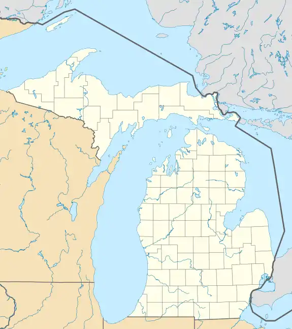
| State | Michigan |
| County | Dickinson |
| Government | |
| • Supervisor | Penny Skogman |
| • Clerk | Lisa Jacobsen |
| Area | |
| • Total | 111.85 sq mi (289.69 km2) |
| • Land | 111.46 sq mi (288.68 km2) |
| • Water | 0.39 sq mi (1.01 km2) |
| Elevation | 1,158 ft (353 m) |
| Population (2020) | |
| • Total | 51 |
| • Density | 0.46/sq mi (0.18/km2) |
| Time zone | UTC-6 (Central (CST)) |
| • Summer (DST) | UTC-5 (CDT) |
| ZIP code(s) | |
| Area code | 906 |
| FIPS code | 26-85520[2] |
| GNIS feature ID | 1627245[3] |
West Branch Township is a civil township of Dickinson County in the U.S. state of Michigan. The population was 51 at the 2020 census.
With a population density of only 0.458/sq mi (0.177/km2), the township ranks as the least-densely populated municipality in the state of Michigan. It is also the third least-populated after Pointe Aux Barques Township (15) and Grand Island Township (35).
Communities
- Alfred is an unincorporated community within the township at 46°05′02″N 87°37′57″W / 46.08389°N 87.63250°W.[4] It lis located near where the north branch of the Ford River joins the main branch. Alfred was settled around 1903 as a station along the Chicago, Minneapolis, and St. Paul Railroad. A post office operated here from December 8, 1903 until November 15, 1910.[5]
- Ralph is an unincorporated community within the township at 46°06′31″N 87°47′01″W / 46.10861°N 87.78361°W.[6] The community as settled in 1901 as a station along the Escanaba and Lake Superior Railroad. It was named for Ralph Wells, who was the son of lumberman J. W. Wells from Menominee. A post office opened on January 17, 1901 with the name Bryden, and it was renamed Ralph on June 6, 1904.[7] The Ralph post office closed in 2012.[8]
Geography
According to the U.S. Census Bureau, the township has a total area of 111.85 square miles (289.69 km2), of which 111.46 square miles (288.68 km2) is land and 0.39 square miles (1.01 km2) (0.35%) is water.[9]
The north and main branches of the Ford River flow through the township, as does the west branch of the Escanaba River.
The township is served by North Dickinson County Schools to the southwest in the community of Felch.[10]
Demographics
As of the census[2] of 2000, there were 67 people, 29 households, and 18 families residing in the township. The population density was 0.6 per square mile (0.2/km2). There were 150 housing units at an average density of 1.3 per square mile (0.5/km2). The racial makeup of the township was 89.55% White, 5.97% Native American, and 4.48% from two or more races. Hispanic or Latino of any race were 4.48% of the population. 16.1% were of Finnish, 10.7% English, 10.7% Swedish, 8.9% French, 8.9% Polish, 7.1% American, 5.4% Dutch and 5.4% German ancestry according to Census 2000.
There were 29 households, out of which 20.7% had children under the age of 18 living with them, 51.7% were married couples living together, 6.9% had a female householder with no husband present, and 37.9% were non-families. 24.1% of all households were made up of individuals, and 10.3% had someone living alone who was 65 years of age or older. The average household size was 2.31 and the average family size was 2.78.
In the township the population was spread out, with 16.4% under the age of 18, 6.0% from 18 to 24, 13.4% from 25 to 44, 44.8% from 45 to 64, and 19.4% who were 65 years of age or older. The median age was 49 years. For every 100 females, there were 123.3 males. For every 100 females age 18 and over, there were 124.0 males.
The median income for a household in the township was $21,875, and the median income for a family was $19,583. Males had a median income of $33,750 versus $18,750 for females. The per capita income for the township was $12,286. There were 11.1% of families and 11.4% of the population living below the poverty line, including no under eighteens and 20.0% of those over 64.
References
- ↑ Michigan Townships Association (2023). "West Branch Township, Dickinson County, Michigan". Retrieved October 15, 2023.
- 1 2 "U.S. Census website". United States Census Bureau. Retrieved January 31, 2008.
- ↑ U.S. Geological Survey Geographic Names Information System: West Branch Township, Dickinson County, Michigan
- ↑ U.S. Geological Survey Geographic Names Information System: Alfred, Michigan
- ↑ Romig 1986, p. 16.
- ↑ U.S. Geological Survey Geographic Names Information System: Ralph, Michigan
- ↑ Romig 1986, p. 464–465.
- ↑ "Ralph Post Office to close". WNMU-FM. November 26, 2012. Retrieved October 31, 2023.
- ↑ "Michigan: 2010 Population and Housing Unit Counts 2010 Census of Population and Housing" (PDF). 2010 United States census. United States Census Bureau. September 2012. p. 20 Michigan. Archived (PDF) from the original on October 19, 2012. Retrieved October 13, 2023.
- ↑ Michigan Geographic Framework (November 15, 2013). "Dickinson County School Districts" (PDF). Retrieved October 28, 2023.
Sources
- Romig, Walter (October 1, 1986) [1973]. Michigan Place Names: The History of the Founding and the Naming of More Than Five Thousand Past and Present Michigan Communities (Paperback). Detroit, Michigan: Wayne State University Press. pp. 16, 464–465. ISBN 978-0-8143-1838-6.
Municipalities and communities of Dickinson County, Michigan, United States | ||
|---|---|---|
| Cities | 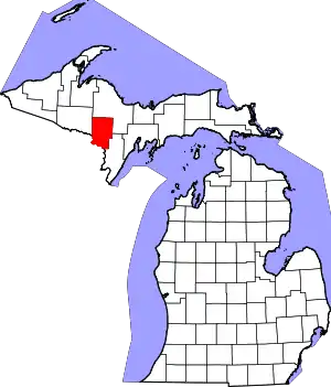 Map of Michigan highlighting Dickinson County.svg | |
| Charter township | ||
| Civil townships | ||
| CDP | ||
| Other communities | ||