Highway 106 | ||||
|---|---|---|---|---|
| Ruta 106 | ||||
| Route information | ||||
| Maintained by Puerto Rico DTPW | ||||
| Length | 18.9 km (11.7 mi) | |||
| Major junctions | ||||
| West end | Calle Méndez Vigo / Calle Oriente in Mayagüez barrio-pueblo | |||
| ||||
| East end | ||||
| Location | ||||
| Country | United States | |||
| Territory | Puerto Rico | |||
| Municipalities | Mayagüez, Las Marías | |||
| Highway system | ||||
| ||||


Puerto Rico Highway 106 (PR-106) is a road that travels from Mayagüez, Puerto Rico to Las Marías.[1] It begins at its intersection with PR-239 (former PR-2R) in downtown Mayagüez and ends at its junction with PR-120 in southern Las Marías, near Maricao.[2] Its eastern segment, from PR-119 to PR-120, is part of the Ruta Panorámica.
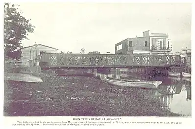 Iron truss bridge over the Yagüez River
Major intersections
| Municipality | Location | km[3] | mi | Destinations | Notes |
|---|---|---|---|---|---|
| Mayagüez | Mayagüez barrio-pueblo | 0.0 | 0.0 | PR-Calle Méndez Vigo / PR-Calle Oriente – Mayagüez | Western terminus of PR-106 |
| 0.4 | 0.25 | ||||
| Mayagüez Arriba | 2.0 | 1.2 | |||
| Quemado | 5.8 | 3.6 | |||
| Bateyes–Quemado line | 6.4 | 4.0 | |||
| Bateyes | 7.4 | 4.6 | |||
| 8.4– 8.5 | 5.2– 5.3 | ||||
| Bateyes–Naranjales line | 10.8 | 6.7 | |||
| Naranjales | 13.7 | 8.5 | Western terminus of PR-119 and the Ruta Panorámica concurrencies; the Ruta Panorámica continues toward Mayagüez | ||
| Mayagüez–Las Marías municipal line | Montoso–Naranjales line | 14.3 | 8.9 | Eastern terminus of PR-119 concurrency | |
| Las Marías | Naranjales–Maravilla Sur line | 18.9 | 11.7 | Eastern terminus of PR-106; eastern terminus of the Ruta Panorámica concurrency; the Ruta Panorámica continues toward Maricao | |
1.000 mi = 1.609 km; 1.000 km = 0.621 mi
| |||||
See also
References
- ↑ National Geographic Maps (2011). Puerto Rico (Map). 1:125,000. Adventure Map (Book 3107). Evergreen, Colorado: National Geographic Maps. ISBN 978-1566955188. OCLC 756511572.
- ↑ "Tránsito Promedio Diario (AADT)". Transit Data (Datos de Transito) (in Spanish). DTOP PR. pp. 57–58. Archived from the original on 1 April 2019.
- ↑ Google (7 March 2020). "PR-106" (Map). Google Maps. Google. Retrieved 7 March 2020.
External links
 Media related to Puerto Rico Highway 106 at Wikimedia Commons
This article is issued from Wikipedia. The text is licensed under Creative Commons - Attribution - Sharealike. Additional terms may apply for the media files.