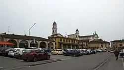
Pontevico
Puntìch | |
|---|---|
| Comune di Pontevico | |
 | |
Location of Pontevico | |
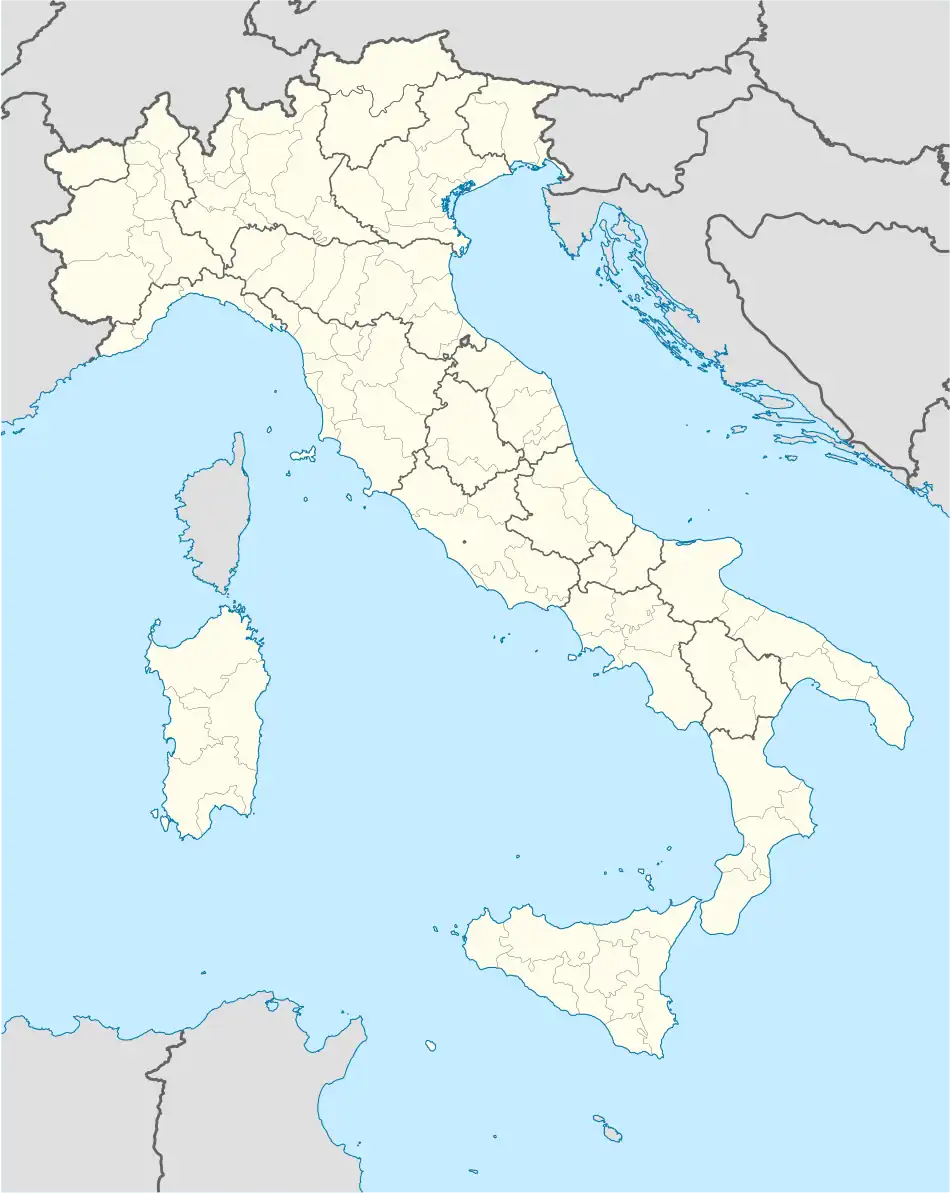 Pontevico Location of Pontevico in Italy 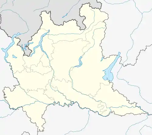 Pontevico Pontevico (Lombardy) | |
| Coordinates: 45°16′20″N 10°5′30″E / 45.27222°N 10.09167°E | |
| Country | Italy |
| Region | Lombardy |
| Province | Brescia (BS) |
| Frazioni | Bettegno, Campazzo, Chiesuola, Gauzza, Torchiera |
| Area | |
| • Total | 29 km2 (11 sq mi) |
| Elevation | 55 m (180 ft) |
| Population (2021)[2] | |
| • Total | 6,931 |
| • Density | 240/km2 (620/sq mi) |
| Demonym | Pontevichesi |
| Time zone | UTC+1 (CET) |
| • Summer (DST) | UTC+2 (CEST) |
| Postal code | 25026 |
| Dialing code | 030 |
| ISTAT code | 017149 |
| Patron saint | San Pancrazio |
| Saint day | 12 May |
| Website | Official website |
Pontevico (Brescian: Puntìch) is a comune in the province of Brescia, in Lombardy. It is situated on the left bank of the river Oglio. As of 2021 Pontevico had a population of 7,038.[2]
Toponymy
The name Pontevico derives from Latin Vicus Pontis, who means " town of the bridge, because the second one had great strategic importance: crossed by the Via Brixiana and built on the Oglio river, it connect yet the province of Brescia to the Cremona's.[3]
History
Before the Roman-Gallic wars, Pontevico was inhabitated by the Cisalpine Gauls. However, probably the town was founded under the Roman Empire: looking at the town from above, the centuriation of the original nucleus is clearly visible. Pontevico was crossed by the Via Brixiana, a Roman consular road who connected Cremona (lat. Cremona) to Brescia (lat. Brixia), from which Roman roads passed and then branched out towards the entire Cisalpine Gaul.[4][5]
In the VI century the navigation's importance was high, so Theodoric had imposed to remove the fishing equipment along the river to don't impede the passage of boats.[6] Due to the Magyars invasions, between the IX and the X century was built a castle in the town,[7] called munitissimum castrum due to his great size.[8]
Until the XIII century, the town was divided into the New and the Old ones, wich had each an own church and an own castle. In this period, were open the first hospices for pilgrisms and sicks: since 1170 is still present today the Hospitale, who give the name to his street.[9]
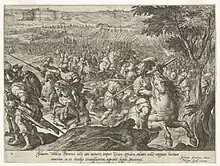
During the High Middle Ages, Pontevico immediately sided with Guelphs and his castle became the theater of battles between the two factions. In 1237, in the eve of the Battle of Cortenuova, the Guelph army was camped in the local fortress but it made the mistake of leave the castle, leaving uncovered the left bank of the Oglio river. So, Federico II could pass the river and he entered in the castle, starting his march to Cortenuova.[10][11]
Until the Wars in Lombardy, Pontevico was a part of the Duchy of Milan, when in 1426 it get conquered by the Republic of Venice. In the last phase of the wars, in 1452 Francesco Sforza regained the town but the next year Jacopo Piccinino bring back Pontevico under the Serenissima. The decisive clash was between 16 and 19 October 1453: the Duke of Milan's army conjoined with the Renè of Anjou's, King of Naples, one for a total of 20,000 infantrymans and 3,500 knights; after three days of siege, Pontevico fell under the milanese army. Then, the town was razed to the ground and especially the french soldiers were very heavy with the population. However, the town after the Treaty of Lodi was bringed back under the Republic of Venice who rebuilt Pontevico and his castle.[12]
Under the venetian rule, Pontevico was a very important port and stronghold for the Serenissima who granted privileges to the town who were named Curia, Castello and Borgo. In the local port there was a trading station where were selt colonial products and imported fodder, linen, iron and wood.[13]
Due to the big importance who venetians gave to Pontevico, his inhabitants especially during the War of the League of Cambrai proved to be very loyal to the Republic,[13] to the point of organizing a revolt against the French were Serenissima was alone against France, Spain and the Holy Roman Empire, in 1510.[14]
During this period, in Pontevico was established the weekly market (1559)[15][16] and was built an abbey church (1584).[17] In 1630, due to the plague of 1629, the local noble Francesco Capparino founded the Pio Luogo Poveri.[18]
With the fall of the Republic of Venice (1797) and the disappearance of the fluvial market, caused by the appearance of the rail transport, the town during the XIX century experienced a phase of decline and the agricolture became the main activity. Due to this transformation, the poverty and the pellagra were very widespread. To solve this problem, during this period on the territory were founded lots of charitable organizations, the biggest one was the Istituto per Frenasteriche ed Epilettiche (1901), founded by Bassano Cremonesini and placed in the castle and still operating.[18][19]
The town industrialisation was so low and the first important industrial center was opened in 1908: it was called Società Filatura di Lino e Canape.[20] But the mass industrialization only occurred during the Italian economic miracle. However the first factory get closed in 1956, in the 1960s his area becamed an artisan settlement.[21]
Then, between the 1960s and the 1970s, started the town expansion (which still continues) when modern neighborhoods and numerous public works were created: the municipal library (1970), the methane network, the new nursery school (1977) and the new primary one (1983), the new and bigger aqueduct, later placed side by side to the wastewater purifier (1986) and the sports center with palasport (1980). During this years, the castle, which was destroyed in 1844 and transformed into a tenement, was profoundly restored and brought back his medieval form. But are also dated back to that period the closure of the Ospedale Civile Gorno Ruffoni, an important hospital located in the hamlet of Chiesuola, in 1977 and the crash of the bridge on the Oglio river, who fell in the same year and was rebuilt in 1978.[9][22]
Transportation
Pontevico is served together with Robecco d'Oglio by a railway station (named Robecco-Pontevico) on the Brescia–Cremona line.
Sources
- ↑ "Superficie di Comuni Province e Regioni italiane al 9 ottobre 2011". Italian National Institute of Statistics. Retrieved 16 March 2019.
- 1 2 ISTAT
- ↑ Berenzi, Angelo (1888). Storia di Pontevico (in Italian). p. 2. ISBN 9788883591051.
- ↑ Milanesi, Carla (1980). Storia di Pontevico (in Italian). p. 15.
- ↑ Berenzi, Angelo (1888). Storia di Pontevico. pp. 1–3. ISBN 9788883591051.
- ↑ Milanesi, Carla. Storia di Pontevico. p. 16.
- ↑ Berenzi, Angelo. Storia di Pontevico. pp. 30–31.
- ↑ Milanesi, Carla. Storia di Pontevico. pp. 20–21.
- 1 2 "PONTEVICO".
- ↑ "CORTENUOVA, BATTAGLIA DI".
- ↑ Berenzi, Angelo. Storia di Pontevico. pp. 113–117.
- ↑ Berenzi, Angelo. Storia di Pontevico. pp. 252–305.
- 1 2 Milanesi, Carla. Storia di Pontevico. pp. 1–4.
- ↑ Berenzi, Angelo. Storia di Pontevico. pp. 346–347.
- ↑ Milanesi, Carla. Storia di Pontevico. pp. 111–112.
- ↑ Berenzi, Angelo. Storia di Pontevico. pp. 402–403.
- ↑ Berenzi, Angelo. Storia di Pontevico. p. 413.
- 1 2 Milanesi, Carla. Storia di Pontevico. pp. 103–106.
- ↑ Ziletti, Nella; Marini. Pontevico, lo stabilimento, i pontevichesi. Luigi. pp. 25–26.
- ↑ Ziletti, Nella; Marini, Luigi. Pontevico, lo stabilimento, i pontevichesi. p. 37.
- ↑ Ziletti, Nella; Marini, Luigi. Pontevico, lo stabilimento, i pontevichesi. p. 85.
- ↑ Milanesi, Carla. Storia di Pontevico. pp. 131–144.