Payne Gap, Kentucky | |
|---|---|
 | |
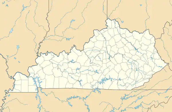 Payne Gap  Payne Gap | |
| Coordinates: 37°09′19″N 82°39′34″W / 37.15528°N 82.65944°W | |
| Country | United States |
| State | Kentucky |
| County | Letcher |
| Area | |
| • Total | 2.30 sq mi (5.97 km2) |
| • Land | 2.30 sq mi (5.97 km2) |
| • Water | 0.00 sq mi (0.00 km2) |
| Elevation | 1,762 ft (537 m) |
| Population (2020) | |
| • Total | 347 |
| • Density | 150.67/sq mi (58.16/km2) |
| Time zone | UTC-5 (Eastern (EST)) |
| • Summer (DST) | UTC-4 (EDT) |
| Area code | 606 |
| GNIS feature ID | 500292[2] |
Payne Gap is an unincorporated community and census-designated place in Letcher County, Kentucky, United States. Its population was 329 as of the 2010 census.[3] U.S. Route 119 passes through the community.
Geography
According to the U.S. Census Bureau, the community has an area of 2.306 square miles (5.97 km2); 2.305 square miles (5.97 km2) of its area is land, and 0.001 square miles (0.0026 km2) is water.[3]
Demographics
As of the 2020 census, there were 347 people, 173 housing units, and 276 families in the CDP. The racial makeup was 96.5% White, 0.6% Asian, and 2.9% from two or more races. A total of 0.6% of the population had Hispanic or Latino origin.[4]
The ancestry was 30.8% American, 13.0% English, 9.5% Irish, 6.4% German, 2.3% French, and 2.3% Scottish.[4]
The median age was 38.2 years old. A total of 5.6% of the population were 65 or older, with 3.1% between the ages of 65 and 74, and 2.4% between the ages of 75 and 84. A total of 29.0% of the population were under 18, with 17.9% between the ages of 5 and 14, and 11.1% between the ages of 15 and 17.[4]
The median household income was $29,375. 47.0% of the population were in poverty.[4]
| Census | Pop. | Note | %± |
|---|---|---|---|
| 2020 | 347 | — | |
| U.S. Decennial Census[5] | |||
References
- ↑ "2020 U.S. Gazetteer Files". United States Census Bureau. Retrieved March 18, 2022.
- ↑ "Payne Gap". Geographic Names Information System. United States Geological Survey, United States Department of the Interior.
- 1 2 "2010 Census Gazetteer Files - Places: Kentucky". U.S. Census Bureau. Retrieved April 2, 2017.
- 1 2 3 4 "Explore Census Data". data.census.gov. Retrieved June 20, 2023.
- ↑ "Census of Population and Housing". Census.gov. Retrieved June 4, 2016.
Municipalities and communities of Letcher County, Kentucky, United States | ||
|---|---|---|
| Cities | 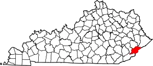 Location of Letcher County, Kentucky | |
| CDPs | ||
| Unincorporated communities | ||
| Ghost towns | ||