Orto | |
|---|---|
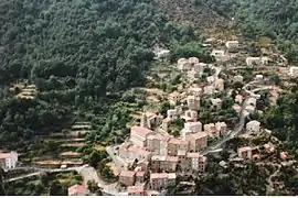 An overhead view of the village | |
Location of Orto | |
 Orto 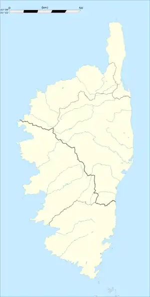 Orto | |
| Coordinates: 42°11′15″N 8°55′59″E / 42.1875°N 8.9331°E | |
| Country | France |
| Region | Corsica |
| Department | Corse-du-Sud |
| Arrondissement | Ajaccio |
| Canton | Sevi-Sorru-Cinarca |
| Government | |
| • Mayor (2020–2026) | Nicolas Rutily[1] |
| Area 1 | 16.21 km2 (6.26 sq mi) |
| Population | 50 |
| • Density | 3.1/km2 (8.0/sq mi) |
| Time zone | UTC+01:00 (CET) |
| • Summer (DST) | UTC+02:00 (CEST) |
| INSEE/Postal code | 2A196 /20125 |
| Elevation | 492–2,280 m (1,614–7,480 ft) (avg. 650 m or 2,130 ft) |
| 1 French Land Register data, which excludes lakes, ponds, glaciers > 1 km2 (0.386 sq mi or 247 acres) and river estuaries. | |
Orto (French pronunciation: [ɔʁto]; Corsican: Ortu) is a commune in the Corse-du-Sud department of France on the island of Corsica.
Population
| Year | Pop. | ±% |
|---|---|---|
| 1962 | 106 | — |
| 1968 | 122 | +15.1% |
| 1975 | 104 | −14.8% |
| 1982 | 89 | −14.4% |
| 1990 | 44 | −50.6% |
| 1999 | 54 | +22.7% |
| 2008 | 58 | +7.4% |
See also
References
- ↑ "Répertoire national des élus: les maires". data.gouv.fr, Plateforme ouverte des données publiques françaises (in French). 2 December 2020.
- ↑ "Populations légales 2020". The National Institute of Statistics and Economic Studies. 29 December 2022.
Wikimedia Commons has media related to Orto (Corse-du-Sud).
This article is issued from Wikipedia. The text is licensed under Creative Commons - Attribution - Sharealike. Additional terms may apply for the media files.