| Oriol | |
|---|---|
| Orisol, Orixol | |
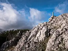 View of the summit | |
| Highest point | |
| Elevation | 1,132 m (3,714 ft) |
| Prominence | 262[1] m (860 ft) |
| Coordinates | 43°3′28″N 2°35′59″W / 43.05778°N 2.59972°W |
| Geography | |
| Location | Álava, Basque Country, Spain |
| Parent range | Anboto range |
| Climbing | |
| Easiest route | Hike |
Oriol (also known as Orisol or Orixol) is a mountain located in the Basque Mountains of the Spanish province of Álava. It overlooks the valley of Aramaio. The most popular trail starts at the Kurtzeta pass.[2]
References
External links
This article is issued from Wikipedia. The text is licensed under Creative Commons - Attribution - Sharealike. Additional terms may apply for the media files.