| Oriomo River | |
|---|---|
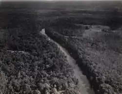 Oriomo River, ca. 1937 | |
| Location | |
| Country | |
| Region | Western Province |
| Physical characteristics | |
| Source | |
| • location | Papua New Guinea |
| Mouth | Coral Sea |
• location | Western Province |
| Length | 86 km (53 mi) |
| Basin size | 1,250.3 km2 (482.7 sq mi) |
| Discharge | |
| • location | Near mouth |
| • average | 46.9 m3/s (1,660 cu ft/s) |
The Oriomo River is located in southern Papua New Guinea. Originating on the Oriomo Plateau, it enters the sea near the town of Daru.[1][2]
See also
References
- ↑ Viner-Smith, Chris (2007). Australia's Forgotten Frontier: The Unsung Police who Held Our PNG Front Line. p. 34. ISBN 9780646475417.
- ↑ Daru.
9°02′09″S 143°10′55″E / 9.03583°S 143.18194°E
This article is issued from Wikipedia. The text is licensed under Creative Commons - Attribution - Sharealike. Additional terms may apply for the media files.