Ohoopee | |
|---|---|
| Country | United States |
| State | Georgia |
| County | Toombs |
| Population (2020) | |
| • Total | 29 |
| Time zone | UTC−6 (Central (CST)) |
| • Summer (DST) | UTC−5 (CDT) |
Ohoopee is an unincorporated community and census-designated place (CDP) in Toombs County, in the U.S. state of Georgia.[1]
It first appeared as a CDP in the 2020 Census with a population of 29.[2]
History
A post office called Ohoopee was established in 1875, and remained in operation until 1953.[3] The community took its name from the nearby Ohoopee River.[4]
The Georgia General Assembly incorporated Ohoopee as a town in 1907.[5] The town's municipal charter was repealed in 1995.[4]
Demographics
| Census | Pop. | Note | %± |
|---|---|---|---|
| 2020 | 29 | — | |
| U.S. Decennial Census[6] 2020[7] | |||
2020 census
| Race / Ethnicity | Pop 2020[7] | % 2020 |
|---|---|---|
| White alone (NH) | 25 | 86.21% |
| Black or African American alone (NH) | 1 | 3.45% |
| Native American or Alaska Native alone (NH) | 0 | 0.00% |
| Asian alone (NH) | 0 | 0.00% |
| Pacific Islander alone (NH) | 0 | 0.00% |
| Some Other Race alone (NH) | 0 | 0.00% |
| Mixed Race/Multi-Racial (NH) | 1 | 3.45% |
| Hispanic or Latino (any race) | 2 | 6.90% |
| Total | 29 | 100.00% |
Note: the US Census treats Hispanic/Latino as an ethnic category. This table excludes Latinos from the racial categories and assigns them to a separate category. Hispanics/Latinos can be of any race.
References
- ↑ U.S. Geological Survey Geographic Names Information System: Ohoopee, Georgia
- ↑ "Ohoopee CDP, Georgia". United States Census Bureau. Retrieved March 13, 2022.
- ↑ "Post Offices". Jim Forte Postal History. Retrieved 30 March 2019.
- 1 2 Krakow, Kenneth K. (1975). Georgia Place-Names: Their History and Origins (PDF). Macon, GA: Winship Press. p. 164. ISBN 0-915430-00-2.
- ↑ Acts Passed by the General Assembly of Georgia. J. Johnston. 1907. p. 869.
- ↑ "Decennial Census of Population and Housing by Decades". US Census Bureau.
- 1 2 "P2 HISPANIC OR LATINO, AND NOT HISPANIC OR LATINO BY RACE – 2020: DEC Redistricting Data (PL 94-171) – Ohoopee CDP, Georgia". United States Census Bureau.
Municipalities and communities of Toombs County, Georgia, United States | ||
|---|---|---|
| Cities | 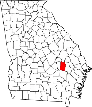 Map of Georgia highlighting Toombs County | |
| CDP | ||
| Footnotes | ‡This populated place also has portions in an adjacent county or counties | |
32°10′49″N 82°13′10″W / 32.18028°N 82.21944°W
This article is issued from Wikipedia. The text is licensed under Creative Commons - Attribution - Sharealike. Additional terms may apply for the media files.