| People | Cree |
|---|---|
| Treaty | Treaty 6 |
| Headquarters | Marcelin |
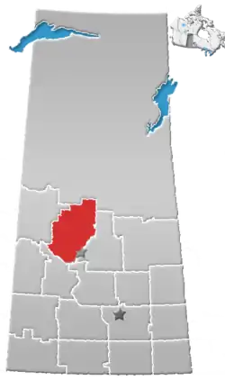
| Province | Saskatchewan |
| Land[1] | |
| Main reserve | Muskeg Lake 102 |
| Other reserve(s) | |
| Population (2023)[1] | |
| On reserve | 403 |
| On other land | 41 |
| Off reserve | 2006 |
| Total population | 2450 |
| Government[1] | |
| Chief | Kelly Wolfe |
| Tribal Council[1] | |
| Saskatoon Tribal Council | |
| Website | |
| muskeglake.com | |
The Muskeg Lake Cree Nation (Cree: ᒪᐢᑫᑯ ᓵᑲᐦᐃᑲᐣ, maskêko-sâkahikan[2]) is a Cree First Nation band government in Marcelin, Saskatchewan, Canada.
The Muskeg Lake Cree Nation is affiliated with the Saskatoon Tribal Council, along with six other First Nations.
Noted people from this reserve include World War II servicewoman Mary Greyeyes, the first indigenous woman to join the Canadian Forces.[3]
Reserves
Muskeg Lake Cree Nation has reserved for itself 15 reserves:[1]
| Reserve | Location | Map | Size | Pop. | Refs. |
|---|---|---|---|---|---|
| Asimakaniseekan Askiy 102A | In the city of Saskatoon | 14.3 ha | [4][5] | ||
| Asimakaniseekan Askiy 102B | In the city of Saskatoon | 0.2 ha | [6][7] | ||
| Lake Pitihkwakew 102B | 35 km northwest of Blaine Lake | 1115 ha | [8][9] | ||
| Muskeg Lake 102 | 93 km north of Saskatoon | 7245.4 ha | 274 | [10][11][12][13] | |
| Muskeg Lake 102B | 67 km northeast of North Battleford | 969.6 ha | 0 | [14][15][16] | |
| Muskeg Lake 102C | |||||
| Muskeg Lake 102D | 43 km southwest of Shellbrook | 131.2 | 0 | [17][18][19] | |
| Muskeg Lake 102E | 49 km south of Shellbrook | 162 ha | 0 | [20][21][22] | |
| Muskeg Lake 102F | 41 km southwest of Shellbrook | 13.9 ha | 20 | [23][24][25] | |
| Muskeg Lake 102G | 27 km north of Blaine Lake | 128.8 ha | 0 | [26][27][28] | |
| Muskeg Lake 102H | |||||
| Muskeg Lake 102J | |||||
| Muskeg Lake 102K | |||||
| Muskeg Lake 102L | |||||
| Muskeg Lake 102M |
References
- 1 2 3 4 5 "First Nation Detail". Crown–Indigenous Relations and Northern Affairs Canada. Government of Canada. 14 November 2008. Retrieved December 28, 2019.
- ↑ Ogg, Arden (August 19, 2015). "Cree Place Names Project". Cree Literacy Network. Retrieved October 21, 2021.
- ↑ "Mary Greyeyes Reid". www.thecanadianencyclopedia.ca. The Canadian Encyclopedia. Retrieved November 5, 2018.
- ↑ "Reserve/Settlement/Village Detail". Crown–Indigenous Relations and Northern Affairs Canada. Government of Canada. 14 November 2008. Retrieved August 12, 2019.
- ↑ "Canada Lands Survey System – CLSS Map Browser". Natural Resources Canada. 13 December 2013. Retrieved 2019-10-09.
- ↑ "Reserve/Settlement/Village Detail". Crown–Indigenous Relations and Northern Affairs Canada. Government of Canada. 14 November 2008. Retrieved August 12, 2019.
- ↑ "Canada Lands Survey System – CLSS Map Browser". Natural Resources Canada. 13 December 2013. Retrieved 2019-10-09.
- ↑ "Reserve/Settlement/Village Detail". Crown–Indigenous Relations and Northern Affairs Canada. Government of Canada. 14 November 2008. Retrieved August 12, 2019.
- ↑ "Canada Lands Survey System - CLSS Map Browser". Natural Resources Canada. 13 December 2013. Retrieved 2019-10-09.
- ↑ "Reserve/Settlement/Village Detail". Crown–Indigenous Relations and Northern Affairs Canada. Government of Canada. 14 November 2008. Retrieved August 12, 2019.
- ↑ "Census Profile, 2016 Census". Statistics Canada. February 8, 2017. Retrieved 2019-08-10.
- ↑ "Canada Lands Survey System - CLSS Map Browser". Natural Resources Canada. 13 December 2013. Retrieved 2019-10-09.
- ↑ "The Community Well-Being index". Indigenous Services Canada. 2019-05-24. Retrieved 2019-10-09.
- ↑ "Reserve/Settlement/Village Detail". Crown–Indigenous Relations and Northern Affairs Canada. Government of Canada. 14 November 2008. Retrieved August 12, 2019.
- ↑ "Census Profile, 2016 Census". Statistics Canada. February 8, 2017. Retrieved 2019-08-10.
- ↑ "Canada Lands Survey System - CLSS Map Browser". Natural Resources Canada. 13 December 2013. Retrieved 2019-10-09.
- ↑ "Reserve/Settlement/Village Detail". Indigenous and Northern Affairs Canada. Government of Canada. 14 November 2008. Retrieved August 12, 2019.
- ↑ "Census Profile, 2016 Census". Statistics Canada. February 8, 2017. Retrieved 2019-08-10.
- ↑ "Canada Lands Survey System - CLSS Map Browser". Natural Resources Canada. 13 December 2013. Retrieved 2019-10-09.
External links
This article is issued from Wikipedia. The text is licensed under Creative Commons - Attribution - Sharealike. Additional terms may apply for the media files.