Montchevreuil | |
|---|---|
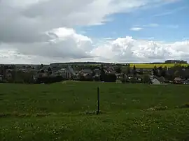 A general view of Fresneaux-Montchevreuil | |
Location of Montchevreuil | |
 Montchevreuil 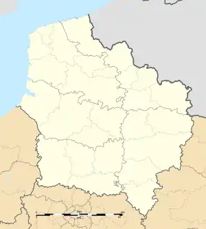 Montchevreuil | |
| Coordinates: 49°16′54″N 2°00′14″E / 49.2817°N 2.0039°E | |
| Country | France |
| Region | Hauts-de-France |
| Department | Oise |
| Arrondissement | Beauvais |
| Canton | Chaumont-en-Vexin |
| Intercommunality | Sablons |
| Area 1 | 17.09 km2 (6.60 sq mi) |
| Population | 1,324 |
| • Density | 77/km2 (200/sq mi) |
| Time zone | UTC+01:00 (CET) |
| • Summer (DST) | UTC+02:00 (CEST) |
| INSEE/Postal code | 60256 /60240 |
| Elevation | 102–186 m (335–610 ft) |
| 1 French Land Register data, which excludes lakes, ponds, glaciers > 1 km2 (0.386 sq mi or 247 acres) and river estuaries. | |
Montchevreuil is a commune in the Oise department in northern France. It was established on 1 January 2019 by merger of the former communes of Fresneaux-Montchevreuil (the seat) and Bachivillers.[2]
See also
References
- ↑ "Populations légales 2020". The National Institute of Statistics and Economic Studies. 29 December 2022.
- ↑ Arrêté préfectoral 26 December 2018 (in French)
Wikimedia Commons has media related to Montchevreuil.
This article is issued from Wikipedia. The text is licensed under Creative Commons - Attribution - Sharealike. Additional terms may apply for the media files.