Mill Creek East, Washington | |
|---|---|
 Mill Creek East, Washington | |
| Coordinates: 47°50′10″N 122°11′16″W / 47.83611°N 122.18778°W | |
| Country | United States |
| State | Washington |
| County | Snohomish |
| Area | |
| • Total | 4.45 sq mi (11.5 km2) |
| • Land | 4.45 sq mi (11.5 km2) |
| Elevation | 354 ft (108 m) |
| Population | |
| • Total | 24,912 |
| • Density | 5,600/sq mi (2,200/km2) |
| Time zone | UTC-8 (PST) |
| • Summer (DST) | UTC-7 (PDT) |
| ZIP code | 98012 |
| Area code(s) | 360, 564 |
Mill Creek East is a census-designated place (CDP) located in Snohomish County, Washington. The population was 24,912 at the 2020 census.[1] The CDP comprises an area southeast of the city of Mill Creek that includes many new single-family housing developments as well as the new North Creek High School.
Demographics
| Census | Pop. | Note | %± |
|---|---|---|---|
| 2010 | 15,709 | — | |
| 2020 | 24,912 | 58.6% | |
| U.S. Decennial Census[2] 2020 Census[1] | |||
2020 census
As of the census of 2020,[3] there were 24,912 people, 8,176 households, and 7,587 families living in the CDP. There were 7,587 housing units. The racial makeup of the CDP was 56.8% White, 2.4% African American, 0.8% Native American, 32.6% Asian, 0.3% Pacific Islander, 1.3% from other races, and 6.0% from two or more races. Hispanic or Latino of any race were 7.2% of the population.
Geography
Mill Creek East is located at coordinates 47°50'10 "N 122°11'16"W.
References
- 1 2 3 "Explore Census Data". Explore Census Data. United States Census Bureau. Retrieved June 22, 2022.
- ↑ United States Census Bureau. "Census of Population and Housing". Retrieved July 26, 2013.
- ↑ United States Census Bureau. "QuickFacts: Mill Creek East CDP, Washington". Retrieved June 22, 2022.
Municipalities and communities of Snohomish County, Washington, United States | ||
|---|---|---|
| Cities | 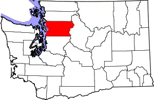 Map of Washington highlighting Snohomish County | |
| Towns | ||
| CDPs |
| |
| Other communities | ||
| Indian reservation | ||
| Military bases | ||
| Ghost town |
| |
| Footnotes | ‡This populated place also has portions in an adjacent county or counties | |
| ||