Mhère | |
|---|---|
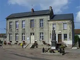 The town hall in Mhère | |
.svg.png.webp) Coat of arms | |
Location of Mhère | |
 Mhère 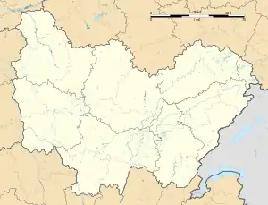 Mhère | |
| Coordinates: 47°12′29″N 3°51′24″E / 47.2081°N 3.8567°E | |
| Country | France |
| Region | Bourgogne-Franche-Comté |
| Department | Nièvre |
| Arrondissement | Clamecy |
| Canton | Corbigny |
| Intercommunality | Tannay-Brinon-Corbigny |
| Government | |
| • Mayor (2020–2026) | Cyril Trinquet[1] |
| Area 1 | 25.25 km2 (9.75 sq mi) |
| Population | 230 |
| • Density | 9.1/km2 (24/sq mi) |
| Time zone | UTC+01:00 (CET) |
| • Summer (DST) | UTC+02:00 (CEST) |
| INSEE/Postal code | 58166 /58140 |
| Elevation | 255–550 m (837–1,804 ft) |
| 1 French Land Register data, which excludes lakes, ponds, glaciers > 1 km2 (0.386 sq mi or 247 acres) and river estuaries. | |
Mhère (French pronunciation: [mɛʁ]) is a commune in the Nièvre department in central France.[3]
According to the Institut Géographique National, between 1 January 2007 and 1 January 2008, Mhère was the geographic centre of the Eurozone, after its enlargement to Slovenia.[4] With the admission of Cyprus and Malta, this centre was moved to Ouroux-en-Morvan.
Demographics
Population development since 1968:
| Year | Pop. | ±% p.a. |
|---|---|---|
| 1968 | 404 | — |
| 1975 | 376 | −1.02% |
| 1982 | 341 | −1.39% |
| 1990 | 310 | −1.18% |
| 1999 | 279 | −1.16% |
| 2009 | 255 | −0.90% |
| 2014 | 238 | −1.37% |
| 2020 | 230 | −0.57% |
| Sources:[5] | ||
See also
References
- ↑ "Répertoire national des élus: les maires". data.gouv.fr, Plateforme ouverte des données publiques françaises (in French). 2 December 2020.
- ↑ "Populations légales 2020". The National Institute of Statistics and Economic Studies. 29 December 2022.
- ↑ INSEE commune file
- ↑ Centre de l’Euroland, IGN Archived 2007-10-31 at the Wayback Machine
- ↑ "Commune de Mhère (58166)". INSEE.
Wikimedia Commons has media related to Mhère.
This article is issued from Wikipedia. The text is licensed under Creative Commons - Attribution - Sharealike. Additional terms may apply for the media files.